J05D Fort Rock, OR, USA - Earthquake Result Viewer
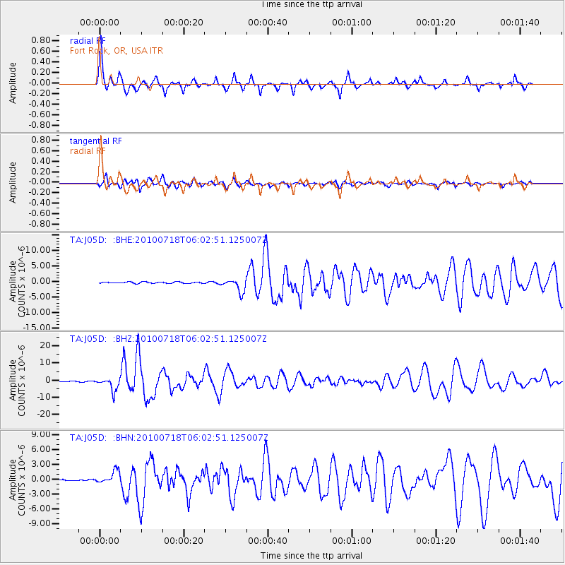
Earthquake location: Fox Islands, Aleutian Islands
Earthquake latitude/longitude: 52.9/-169.8
Earthquake time(UTC): 2010/07/18 (199) 05:56:44 GMT
Earthquake Depth: 14 km
Earthquake Magnitude: 6.3 MB, 6.7 MS, 6.6 MW, 6.6 MW
Earthquake Catalog/Contributor: WHDF/NEIC
Network: TA USArray Transportable Network (new EarthScope stations)
Station: J05D Fort Rock, OR, USA
Lat/Lon: 43.28 N/121.23 W
Elevation: 1541 m
Distance: 33.3 deg
Az: 86.857 deg
Baz: 304.028 deg
Ray Param: 0.07827264
Estimated Moho Depth: 66.25 km
Estimated Crust Vp/Vs: 1.98
Assumed Crust Vp: 6.597 km/s
Estimated Crust Vs: 3.336 km/s
Estimated Crust Poisson's Ratio: 0.33
Radial Match: 92.108734 %
Radial Bump: 400
Transverse Match: 81.28748 %
Transverse Bump: 400
SOD ConfigId: 319893
Insert Time: 2011-01-05 06:00:57.594 +0000
GWidth: 2.5
Max Bumps: 400
Tol: 0.001

Signal To Noise

ChannelStoNSTALTA
TA:J05D: :BHZ:20100718T06:02:51.125007Z35.794433.9819947E-61.11246216E-7
TA:J05D: :BHN:20100718T06:02:51.125007Z8.7162081.3607195E-61.5611369E-7
TA:J05D: :BHE:20100718T06:02:51.125007Z9.93279652.1928251E-62.2076615E-7
Arrivals
Ps11 SECOND
PpPs28 SECOND
PsPs/PpSs38 SECOND