W32A Sentinel, OK, USA - Earthquake Result Viewer
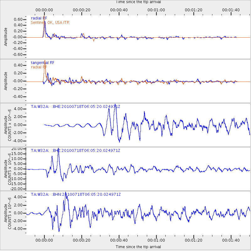
Earthquake location: Fox Islands, Aleutian Islands
Earthquake latitude/longitude: 52.9/-169.8
Earthquake time(UTC): 2010/07/18 (199) 05:56:44 GMT
Earthquake Depth: 14 km
Earthquake Magnitude: 6.3 MB, 6.7 MS, 6.6 MW, 6.6 MW
Earthquake Catalog/Contributor: WHDF/NEIC
Network: TA USArray Transportable Network (new EarthScope stations)
Station: W32A Sentinel, OK, USA
Lat/Lon: 35.12 N/99.25 W
Elevation: 494 m
Distance: 51.6 deg
Az: 80.411 deg
Baz: 313.19 deg
Ray Param: 0.06727084
Estimated Moho Depth: 49.75 km
Estimated Crust Vp/Vs: 1.69
Assumed Crust Vp: 6.315 km/s
Estimated Crust Vs: 3.731 km/s
Estimated Crust Poisson's Ratio: 0.23
Radial Match: 95.49407 %
Radial Bump: 390
Transverse Match: 86.82933 %
Transverse Bump: 400
SOD ConfigId: 319893
Insert Time: 2011-01-05 06:02:26.451 +0000
GWidth: 2.5
Max Bumps: 400
Tol: 0.001

Signal To Noise

ChannelStoNSTALTA
TA:W32A: :BHZ:20100718T06:05:20.024971Z41.126064.8677034E-61.1836056E-7
TA:W32A: :BHN:20100718T06:05:20.024971Z7.42124371.3201844E-61.7789263E-7
TA:W32A: :BHE:20100718T06:05:20.024971Z7.97145181.8346171E-62.3014843E-7
Arrivals
Ps5.8 SECOND
PpPs20 SECOND
PsPs/PpSs26 SECOND