434A Burnet, TX, USA - Earthquake Result Viewer
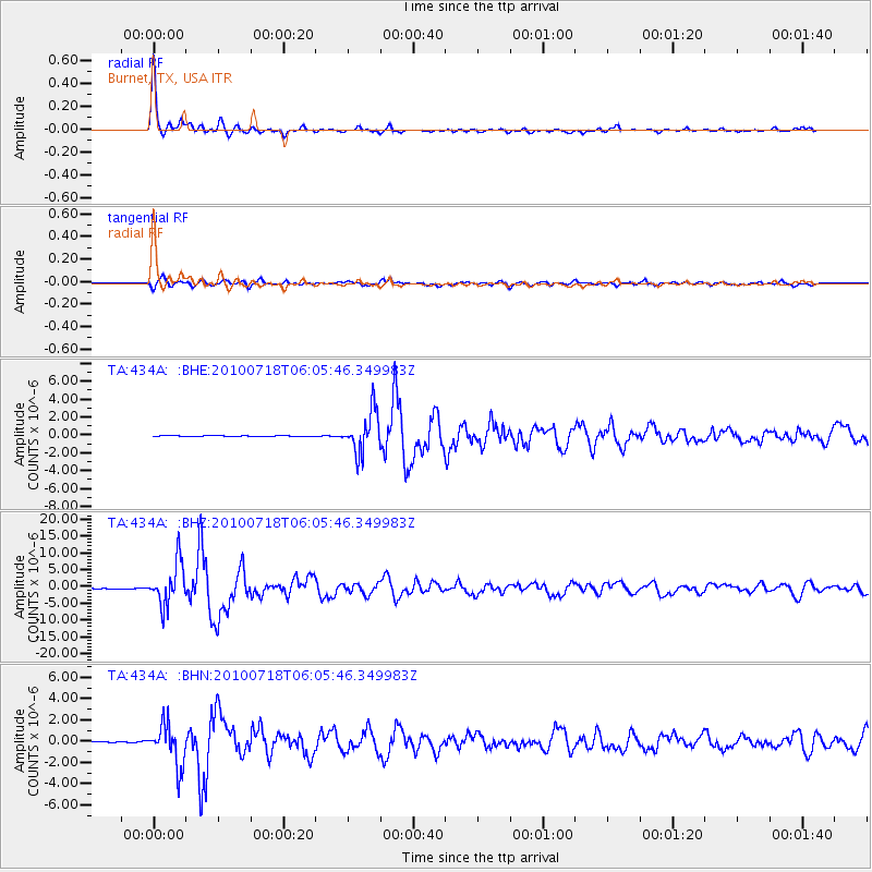
Earthquake location: Fox Islands, Aleutian Islands
Earthquake latitude/longitude: 52.9/-169.8
Earthquake time(UTC): 2010/07/18 (199) 05:56:44 GMT
Earthquake Depth: 14 km
Earthquake Magnitude: 6.3 MB, 6.7 MS, 6.6 MW, 6.6 MW
Earthquake Catalog/Contributor: WHDF/NEIC
Network: TA USArray Transportable Network (new EarthScope stations)
Station: 434A Burnet, TX, USA
Lat/Lon: 30.81 N/98.27 W
Elevation: 462 m
Distance: 55.2 deg
Az: 83.52 deg
Baz: 315.572 deg
Ray Param: 0.06491662
Estimated Moho Depth: 23.0 km
Estimated Crust Vp/Vs: 2.10
Assumed Crust Vp: 6.498 km/s
Estimated Crust Vs: 3.098 km/s
Estimated Crust Poisson's Ratio: 0.35
Radial Match: 98.44988 %
Radial Bump: 282
Transverse Match: 92.23062 %
Transverse Bump: 400
SOD ConfigId: 319893
Insert Time: 2011-01-05 06:03:32.172 +0000
GWidth: 2.5
Max Bumps: 400
Tol: 0.001

Signal To Noise

ChannelStoNSTALTA
TA:434A: :BHZ:20100718T06:05:46.349983Z74.720426.2372587E-68.347462E-8
TA:434A: :BHN:20100718T06:05:46.349983Z39.426881.9358195E-64.9098976E-8
TA:434A: :BHE:20100718T06:05:46.349983Z40.389652.290377E-65.6707034E-8
Arrivals
Ps4.1 SECOND
PpPs10 SECOND
PsPs/PpSs15 SECOND