234A Clairette, TX, USA - Earthquake Result Viewer
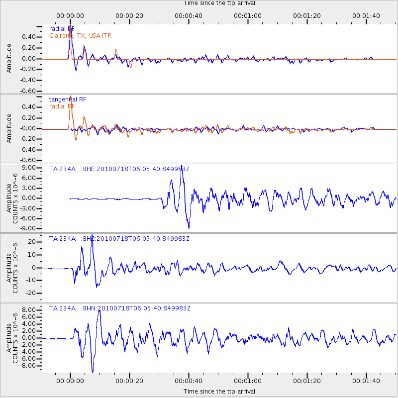
Earthquake location: Fox Islands, Aleutian Islands
Earthquake latitude/longitude: 52.9/-169.8
Earthquake time(UTC): 2010/07/18 (199) 05:56:44 GMT
Earthquake Depth: 14 km
Earthquake Magnitude: 6.3 MB, 6.7 MS, 6.6 MW, 6.6 MW
Earthquake Catalog/Contributor: WHDF/NEIC
Network: TA USArray Transportable Network (new EarthScope stations)
Station: 234A Clairette, TX, USA
Lat/Lon: 32.00 N/98.14 W
Elevation: 358 m
Distance: 54.5 deg
Az: 82.401 deg
Baz: 314.997 deg
Ray Param: 0.065417215
Estimated Moho Depth: 37.25 km
Estimated Crust Vp/Vs: 1.76
Assumed Crust Vp: 6.426 km/s
Estimated Crust Vs: 3.651 km/s
Estimated Crust Poisson's Ratio: 0.26
Radial Match: 97.497154 %
Radial Bump: 391
Transverse Match: 91.356865 %
Transverse Bump: 400
SOD ConfigId: 319893
Insert Time: 2011-01-05 06:04:36.168 +0000
GWidth: 2.5
Max Bumps: 400
Tol: 0.001

Signal To Noise

ChannelStoNSTALTA
TA:234A: :BHZ:20100718T06:05:40.849983Z69.467186.3389134E-69.125048E-8
TA:234A: :BHN:20100718T06:05:40.849983Z36.438242.3959312E-66.575321E-8
TA:234A: :BHE:20100718T06:05:40.849983Z30.8388822.3900925E-67.750256E-8
Arrivals
Ps4.6 SECOND
PpPs15 SECOND
PsPs/PpSs20 SECOND