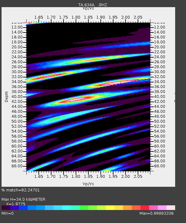
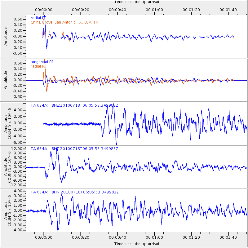
634A China Grove, San Antonio TX, USA - Earthquake Result Viewer

Earthquake location: Fox Islands, Aleutian Islands
Earthquake latitude/longitude: 52.9/-169.8
Earthquake time(UTC): 2010/07/18 (199) 05:56:44 GMT
Earthquake Depth: 14 km
Earthquake Magnitude: 6.3 MB, 6.7 MS, 6.6 MW, 6.6 MW
Earthquake Catalog/Contributor: WHDF/NEIC
Network: TA USArray Transportable Network (new EarthScope stations)
Station: 634A China Grove, San Antonio TX, USA
Lat/Lon: 29.38 N/98.35 W
Elevation: 188 m
Distance: 56.2 deg
Az: 84.784 deg
Baz: 316.243 deg
Ray Param: 0.064279936
Estimated Moho Depth: 34.0 km
Estimated Crust Vp/Vs: 1.98
Assumed Crust Vp: 6.347 km/s
Estimated Crust Vs: 3.21 km/s
Estimated Crust Poisson's Ratio: 0.33
Radial Match: 92.24701 %
Radial Bump: 400
Transverse Match: 83.96672 %
Transverse Bump: 400
SOD ConfigId: 319893
Insert Time: 2011-01-05 06:05:19.148 +0000
GWidth: 2.5
Max Bumps: 400
Tol: 0.001

Signal To Noise

ChannelStoNSTALTA
TA:634A: :BHZ:20100718T06:05:53.349983Z42.6378634.674886E-61.09641654E-7
TA:634A: :BHN:20100718T06:05:53.349983Z13.41340351.310562E-69.77054E-8
TA:634A: :BHE:20100718T06:05:53.349983Z13.7629212.440234E-61.7730495E-7
Arrivals
Ps5.5 SECOND
PpPs15 SECOND
PsPs/PpSs21 SECOND