535A Dale, TX, USA - Earthquake Result Viewer
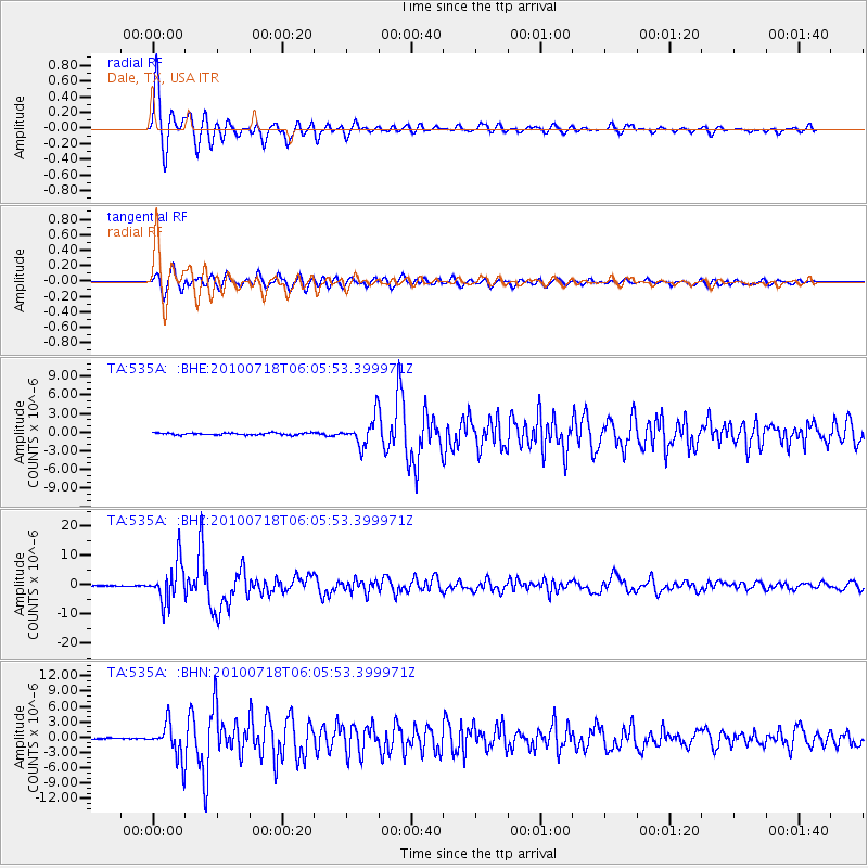
Earthquake location: Fox Islands, Aleutian Islands
Earthquake latitude/longitude: 52.9/-169.8
Earthquake time(UTC): 2010/07/18 (199) 05:56:44 GMT
Earthquake Depth: 14 km
Earthquake Magnitude: 6.3 MB, 6.7 MS, 6.6 MW, 6.6 MW
Earthquake Catalog/Contributor: WHDF/NEIC
Network: TA USArray Transportable Network (new EarthScope stations)
Station: 535A Dale, TX, USA
Lat/Lon: 30.03 N/97.57 W
Elevation: 170 m
Distance: 56.2 deg
Az: 83.657 deg
Baz: 316.001 deg
Ray Param: 0.06427637
Estimated Moho Depth: 17.75 km
Estimated Crust Vp/Vs: 1.99
Assumed Crust Vp: 6.347 km/s
Estimated Crust Vs: 3.189 km/s
Estimated Crust Poisson's Ratio: 0.33
Radial Match: 95.14564 %
Radial Bump: 400
Transverse Match: 87.95768 %
Transverse Bump: 400
SOD ConfigId: 319893
Insert Time: 2011-01-05 06:05:31.846 +0000
GWidth: 2.5
Max Bumps: 400
Tol: 0.001

Signal To Noise

ChannelStoNSTALTA
TA:535A: :BHZ:20100718T06:05:53.399971Z70.294786.7438627E-69.59369E-8
TA:535A: :BHN:20100718T06:05:53.399971Z21.5423583.3427584E-61.5517142E-7
TA:535A: :BHE:20100718T06:05:53.399971Z14.1237482.2264926E-61.5764178E-7
Arrivals
Ps2.9 SECOND
PpPs8.0 SECOND
PsPs/PpSs11 SECOND