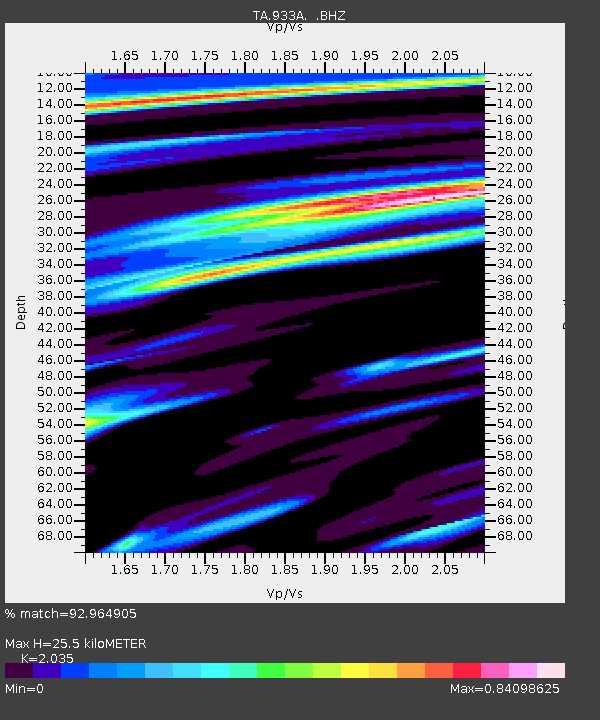
933A Laredo, TX, USA - Earthquake Result Viewer
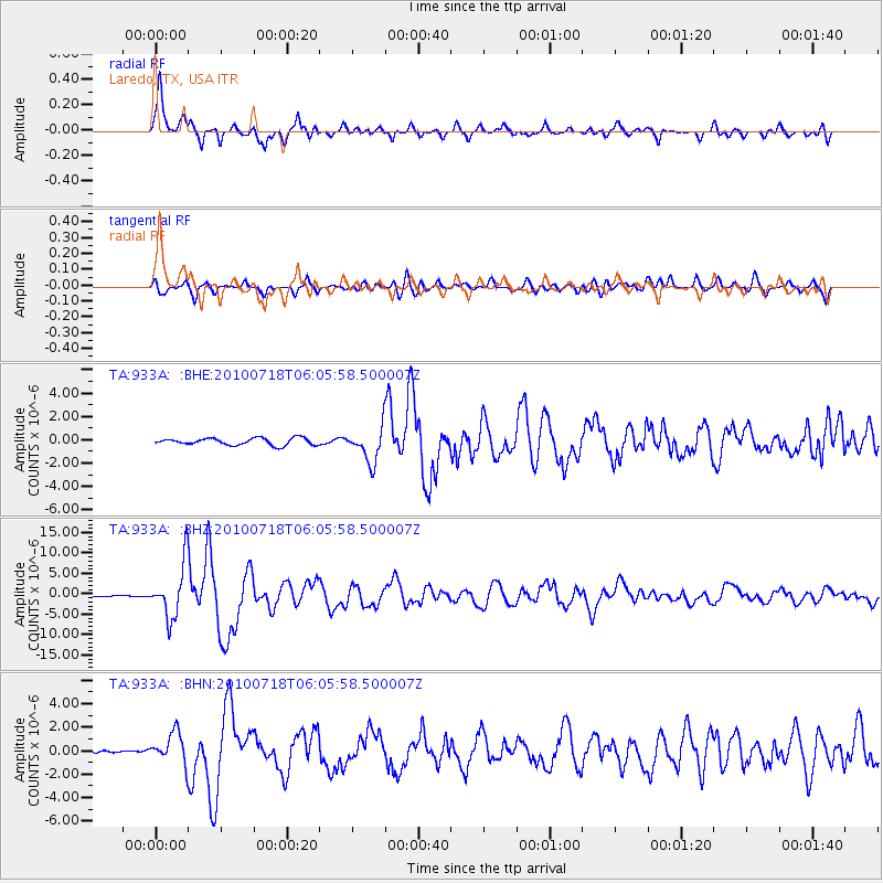
Earthquake location: Fox Islands, Aleutian Islands
Earthquake latitude/longitude: 52.9/-169.8
Earthquake time(UTC): 2010/07/18 (199) 05:56:44 GMT
Earthquake Depth: 14 km
Earthquake Magnitude: 6.3 MB, 6.7 MS, 6.6 MW, 6.6 MW
Earthquake Catalog/Contributor: WHDF/NEIC
Network: TA USArray Transportable Network (new EarthScope stations)
Station: 933A Laredo, TX, USA
Lat/Lon: 27.61 N/99.27 W
Elevation: 214 m
Distance: 56.9 deg
Az: 86.942 deg
Baz: 316.994 deg
Ray Param: 0.06380727
Estimated Moho Depth: 25.5 km
Estimated Crust Vp/Vs: 2.04
Assumed Crust Vp: 6.096 km/s
Estimated Crust Vs: 2.995 km/s
Estimated Crust Poisson's Ratio: 0.34
Radial Match: 92.964905 %
Radial Bump: 400
Transverse Match: 77.372826 %
Transverse Bump: 400
SOD ConfigId: 319893
Insert Time: 2011-01-05 06:05:58.922 +0000
GWidth: 2.5
Max Bumps: 400
Tol: 0.001

Signal To Noise

ChannelStoNSTALTA
TA:933A: :BHZ:20100718T06:05:58.500007Z56.2719766.4831806E-61.15211535E-7
TA:933A: :BHN:20100718T06:05:58.500007Z10.0955181.2950613E-61.2828082E-7
TA:933A: :BHE:20100718T06:05:58.500007Z4.9276571.4767436E-62.9968473E-7
Arrivals
Ps4.5 SECOND
PpPs12 SECOND
PsPs/PpSs17 SECOND