339A Huntington, TX, USA - Earthquake Result Viewer
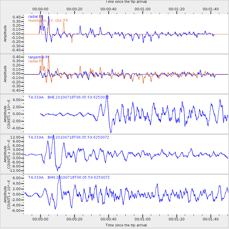
Earthquake location: Fox Islands, Aleutian Islands
Earthquake latitude/longitude: 52.9/-169.8
Earthquake time(UTC): 2010/07/18 (199) 05:56:44 GMT
Earthquake Depth: 14 km
Earthquake Magnitude: 6.3 MB, 6.7 MS, 6.6 MW, 6.6 MW
Earthquake Catalog/Contributor: WHDF/NEIC
Network: TA USArray Transportable Network (new EarthScope stations)
Station: 339A Huntington, TX, USA
Lat/Lon: 31.33 N/94.56 W
Elevation: 82 m
Distance: 57.1 deg
Az: 80.342 deg
Baz: 315.71 deg
Ray Param: 0.06370218
Estimated Moho Depth: 10.0 km
Estimated Crust Vp/Vs: 1.99
Assumed Crust Vp: 5.738 km/s
Estimated Crust Vs: 2.891 km/s
Estimated Crust Poisson's Ratio: 0.33
Radial Match: 93.210045 %
Radial Bump: 343
Transverse Match: 88.18128 %
Transverse Bump: 400
SOD ConfigId: 319893
Insert Time: 2011-01-05 06:07:28.540 +0000
GWidth: 2.5
Max Bumps: 400
Tol: 0.001

Signal To Noise

ChannelStoNSTALTA
TA:339A: :BHZ:20100718T06:05:59.625007Z16.9074214.3009577E-62.5438283E-7
TA:339A: :BHN:20100718T06:05:59.625007Z4.75127741.2922909E-62.7198809E-7
TA:339A: :BHE:20100718T06:05:59.625007Z4.1863329.318158E-72.2258524E-7
Arrivals
Ps1.8 SECOND
PpPs5.0 SECOND
PsPs/PpSs6.8 SECOND