
338A Crockett, TX, USA - Earthquake Result Viewer
| ||||||||||||||||||
| ||||||||||||||||||
| ||||||||||||||||||
|
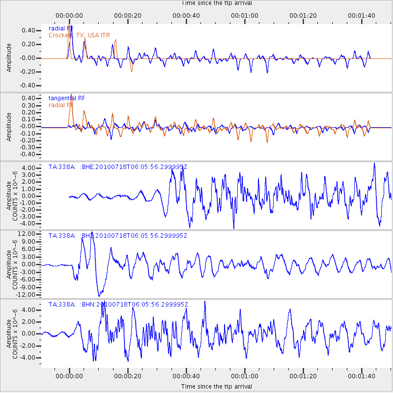
Signal To Noise
| Channel | StoN | STA | LTA |
| TA:338A: :BHZ:20100718T06:05:56.299995Z | 23.691465 | 4.468282E-6 | 1.8860302E-7 |
| TA:338A: :BHN:20100718T06:05:56.299995Z | 3.374581 | 1.0486809E-6 | 3.1075885E-7 |
| TA:338A: :BHE:20100718T06:05:56.299995Z | 5.8204236 | 1.547864E-6 | 2.6593665E-7 |
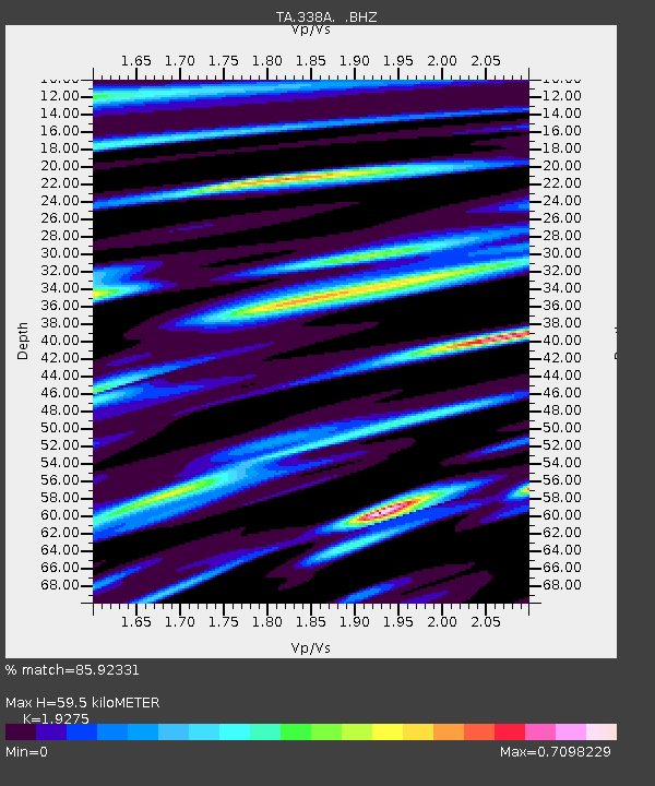
| Arrivals | |
| Ps | 10.0 SECOND |
| PpPs | 29 SECOND |
| PsPs/PpSs | 39 SECOND |

