239A Gary, TX, USA - Earthquake Result Viewer
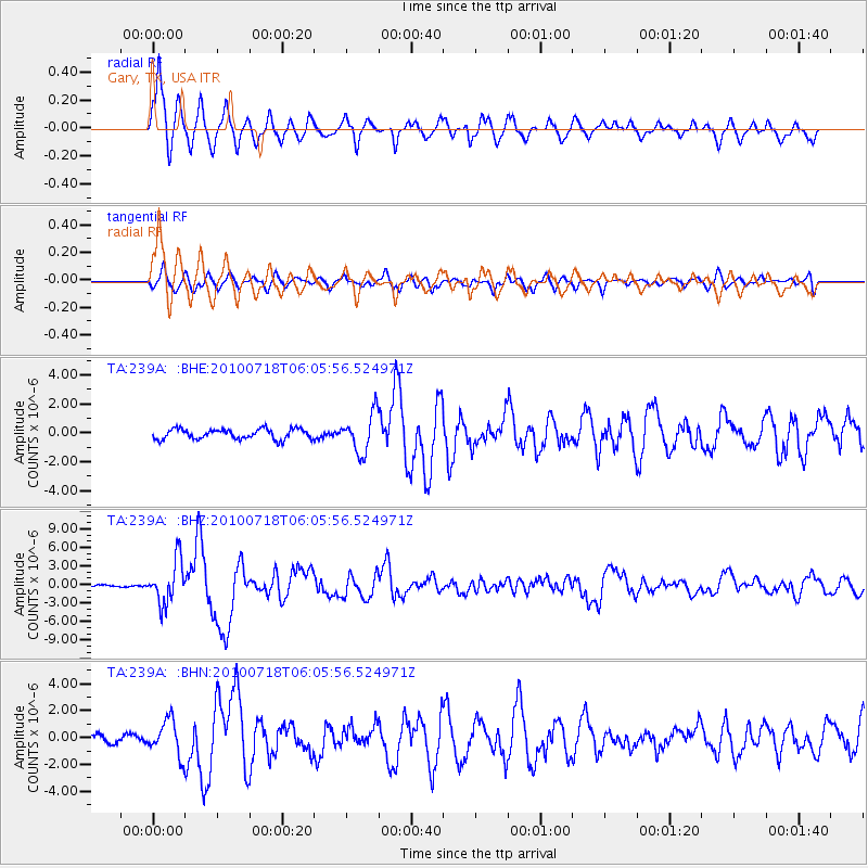
Earthquake location: Fox Islands, Aleutian Islands
Earthquake latitude/longitude: 52.9/-169.8
Earthquake time(UTC): 2010/07/18 (199) 05:56:44 GMT
Earthquake Depth: 14 km
Earthquake Magnitude: 6.3 MB, 6.7 MS, 6.6 MW, 6.6 MW
Earthquake Catalog/Contributor: WHDF/NEIC
Network: TA USArray Transportable Network (new EarthScope stations)
Station: 239A Gary, TX, USA
Lat/Lon: 32.02 N/94.47 W
Elevation: 100 m
Distance: 56.7 deg
Az: 79.71 deg
Baz: 315.409 deg
Ray Param: 0.06398904
Estimated Moho Depth: 57.5 km
Estimated Crust Vp/Vs: 1.76
Assumed Crust Vp: 6.245 km/s
Estimated Crust Vs: 3.538 km/s
Estimated Crust Poisson's Ratio: 0.26
Radial Match: 87.61476 %
Radial Bump: 396
Transverse Match: 79.91543 %
Transverse Bump: 400
SOD ConfigId: 319893
Insert Time: 2011-01-05 06:07:57.934 +0000
GWidth: 2.5
Max Bumps: 400
Tol: 0.001

Signal To Noise

ChannelStoNSTALTA
TA:239A: :BHZ:20100718T06:05:56.524971Z24.632523.4659158E-61.4070488E-7
TA:239A: :BHN:20100718T06:05:56.524971Z6.5440321.294044E-61.9774414E-7
TA:239A: :BHE:20100718T06:05:56.524971Z3.87985541.3472779E-63.472495E-7
Arrivals
Ps7.4 SECOND
PpPs24 SECOND
PsPs/PpSs32 SECOND