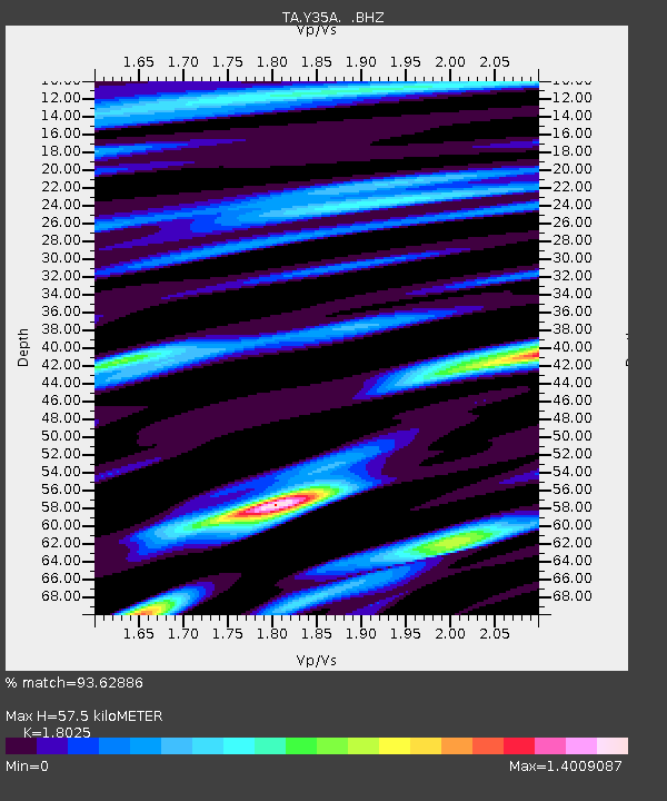
Y35A Marietta, OK, USA - Earthquake Result Viewer
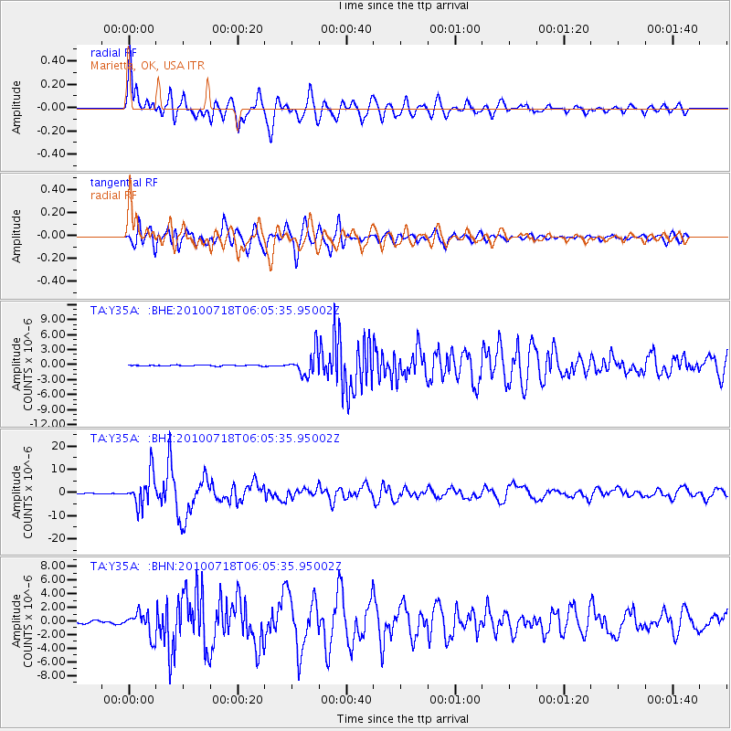
Earthquake location: Fox Islands, Aleutian Islands
Earthquake latitude/longitude: 52.9/-169.8
Earthquake time(UTC): 2010/07/18 (199) 05:56:44 GMT
Earthquake Depth: 14 km
Earthquake Magnitude: 6.3 MB, 6.7 MS, 6.6 MW, 6.6 MW
Earthquake Catalog/Contributor: WHDF/NEIC
Network: TA USArray Transportable Network (new EarthScope stations)
Station: Y35A Marietta, OK, USA
Lat/Lon: 33.91 N/97.04 W
Elevation: 214 m
Distance: 53.8 deg
Az: 79.933 deg
Baz: 314.146 deg
Ray Param: 0.06584741
Estimated Moho Depth: 57.5 km
Estimated Crust Vp/Vs: 1.80
Assumed Crust Vp: 6.38 km/s
Estimated Crust Vs: 3.54 km/s
Estimated Crust Poisson's Ratio: 0.28
Radial Match: 93.62886 %
Radial Bump: 400
Transverse Match: 91.065315 %
Transverse Bump: 400
SOD ConfigId: 319893
Insert Time: 2011-01-05 06:10:09.598 +0000
GWidth: 2.5
Max Bumps: 400
Tol: 0.001

Signal To Noise

ChannelStoNSTALTA
TA:Y35A: :BHZ:20100718T06:05:35.95002Z64.1688166.914638E-61.0775698E-7
TA:Y35A: :BHN:20100718T06:05:35.95002Z6.8156281.741474E-62.5551188E-7
TA:Y35A: :BHE:20100718T06:05:35.95002Z23.8950962.3991226E-61.00402296E-7
Arrivals
Ps7.6 SECOND
PpPs24 SECOND
PsPs/PpSs32 SECOND