Y36A Durant, OK, USA - Earthquake Result Viewer
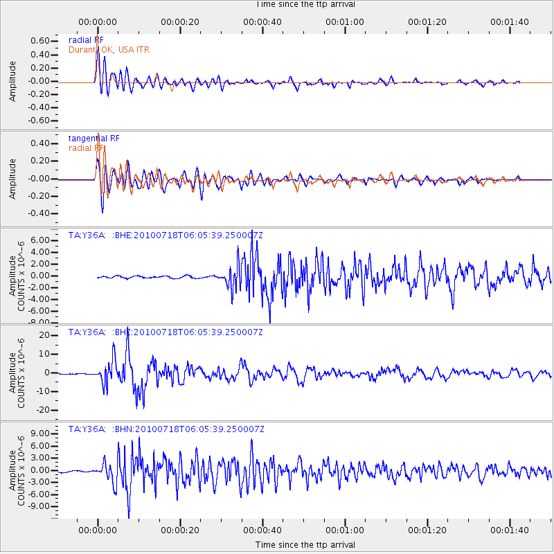
Earthquake location: Fox Islands, Aleutian Islands
Earthquake latitude/longitude: 52.9/-169.8
Earthquake time(UTC): 2010/07/18 (199) 05:56:44 GMT
Earthquake Depth: 14 km
Earthquake Magnitude: 6.3 MB, 6.7 MS, 6.6 MW, 6.6 MW
Earthquake Catalog/Contributor: WHDF/NEIC
Network: TA USArray Transportable Network (new EarthScope stations)
Station: Y36A Durant, OK, USA
Lat/Lon: 33.90 N/96.28 W
Elevation: 186 m
Distance: 54.3 deg
Az: 79.4 deg
Baz: 314.251 deg
Ray Param: 0.065554224
Estimated Moho Depth: 18.0 km
Estimated Crust Vp/Vs: 1.60
Assumed Crust Vp: 6.38 km/s
Estimated Crust Vs: 3.988 km/s
Estimated Crust Poisson's Ratio: 0.18
Radial Match: 91.1399 %
Radial Bump: 400
Transverse Match: 90.92764 %
Transverse Bump: 400
SOD ConfigId: 319893
Insert Time: 2011-01-05 06:10:15.810 +0000
GWidth: 2.5
Max Bumps: 400
Tol: 0.001

Signal To Noise

ChannelStoNSTALTA
TA:Y36A: :BHZ:20100718T06:05:39.250007Z29.9318186.4373917E-62.1506851E-7
TA:Y36A: :BHN:20100718T06:05:39.250007Z7.7001272.4876392E-63.230647E-7
TA:Y36A: :BHE:20100718T06:05:39.250007Z10.719191.8694003E-61.7439754E-7
Arrivals
Ps1.8 SECOND
PpPs6.9 SECOND
PsPs/PpSs8.7 SECOND