Q34A Chapman, KS, USA - Earthquake Result Viewer
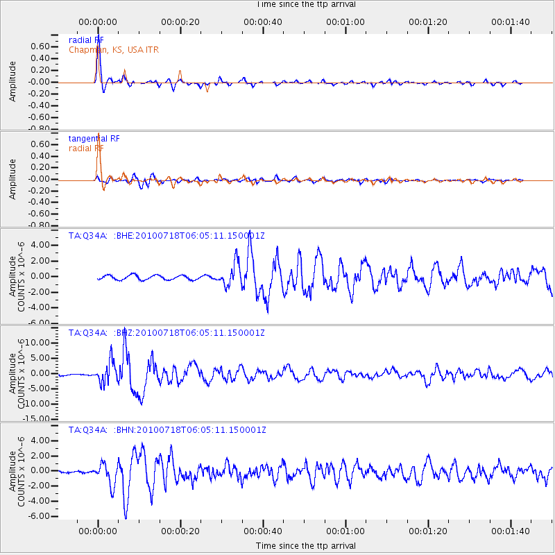
Earthquake location: Fox Islands, Aleutian Islands
Earthquake latitude/longitude: 52.9/-169.8
Earthquake time(UTC): 2010/07/18 (199) 05:56:44 GMT
Earthquake Depth: 14 km
Earthquake Magnitude: 6.3 MB, 6.7 MS, 6.6 MW, 6.6 MW
Earthquake Catalog/Contributor: WHDF/NEIC
Network: TA USArray Transportable Network (new EarthScope stations)
Station: Q34A Chapman, KS, USA
Lat/Lon: 38.92 N/96.94 W
Elevation: 378 m
Distance: 50.5 deg
Az: 75.208 deg
Baz: 311.3 deg
Ray Param: 0.06803322
Estimated Moho Depth: 50.0 km
Estimated Crust Vp/Vs: 1.77
Assumed Crust Vp: 6.483 km/s
Estimated Crust Vs: 3.657 km/s
Estimated Crust Poisson's Ratio: 0.27
Radial Match: 97.35432 %
Radial Bump: 319
Transverse Match: 86.38551 %
Transverse Bump: 400
SOD ConfigId: 319893
Insert Time: 2011-01-05 06:11:20.461 +0000
GWidth: 2.5
Max Bumps: 400
Tol: 0.001

Signal To Noise

ChannelStoNSTALTA
TA:Q34A: :BHZ:20100718T06:05:11.150001Z12.5022263.5363084E-62.828543E-7
TA:Q34A: :BHN:20100718T06:05:11.150001Z10.7613591.4437492E-61.3416049E-7
TA:Q34A: :BHE:20100718T06:05:11.150001Z5.19565251.4858209E-62.8597387E-7
Arrivals
Ps6.3 SECOND
PpPs20 SECOND
PsPs/PpSs26 SECOND