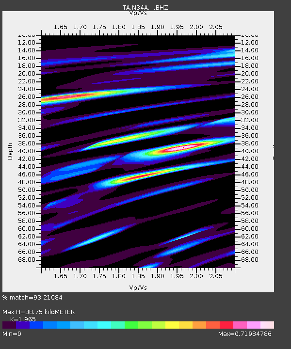
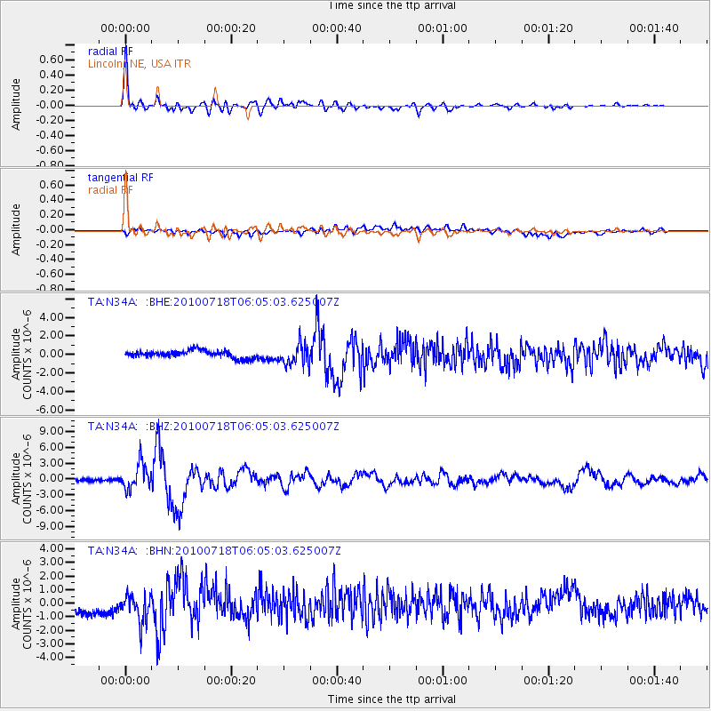
N34A Lincoln, NE, USA - Earthquake Result Viewer

Earthquake location: Fox Islands, Aleutian Islands
Earthquake latitude/longitude: 52.9/-169.8
Earthquake time(UTC): 2010/07/18 (199) 05:56:44 GMT
Earthquake Depth: 14 km
Earthquake Magnitude: 6.3 MB, 6.7 MS, 6.6 MW, 6.6 MW
Earthquake Catalog/Contributor: WHDF/NEIC
Network: TA USArray Transportable Network (new EarthScope stations)
Station: N34A Lincoln, NE, USA
Lat/Lon: 40.84 N/96.50 W
Elevation: 401 m
Distance: 49.5 deg
Az: 73.025 deg
Baz: 310.177 deg
Ray Param: 0.068672456
Estimated Moho Depth: 38.75 km
Estimated Crust Vp/Vs: 1.97
Assumed Crust Vp: 6.498 km/s
Estimated Crust Vs: 3.307 km/s
Estimated Crust Poisson's Ratio: 0.33
Radial Match: 93.21084 %
Radial Bump: 400
Transverse Match: 54.65545 %
Transverse Bump: 400
SOD ConfigId: 319893
Insert Time: 2011-01-05 06:11:32.740 +0000
GWidth: 2.5
Max Bumps: 400
Tol: 0.001

Signal To Noise

ChannelStoNSTALTA
TA:N34A: :BHZ:20100718T06:05:03.625007Z11.8561572.4636977E-62.07799E-7
TA:N34A: :BHN:20100718T06:05:03.625007Z2.41710831.0246089E-64.2389865E-7
TA:N34A: :BHE:20100718T06:05:03.625007Z3.01905351.1804676E-63.9100587E-7
Arrivals
Ps6.1 SECOND
PpPs17 SECOND
PsPs/PpSs23 SECOND