N35A Tabor, IA, USA - Earthquake Result Viewer
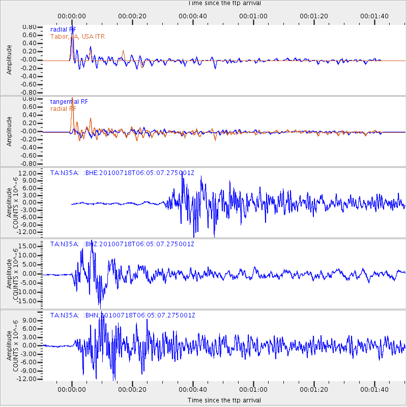
Earthquake location: Fox Islands, Aleutian Islands
Earthquake latitude/longitude: 52.9/-169.8
Earthquake time(UTC): 2010/07/18 (199) 05:56:44 GMT
Earthquake Depth: 14 km
Earthquake Magnitude: 6.3 MB, 6.7 MS, 6.6 MW, 6.6 MW
Earthquake Catalog/Contributor: WHDF/NEIC
Network: TA USArray Transportable Network (new EarthScope stations)
Station: N35A Tabor, IA, USA
Lat/Lon: 40.86 N/95.64 W
Elevation: 353 m
Distance: 49.9 deg
Az: 72.45 deg
Baz: 310.364 deg
Ray Param: 0.06836641
Estimated Moho Depth: 16.25 km
Estimated Crust Vp/Vs: 1.73
Assumed Crust Vp: 6.498 km/s
Estimated Crust Vs: 3.75 km/s
Estimated Crust Poisson's Ratio: 0.25
Radial Match: 94.31989 %
Radial Bump: 400
Transverse Match: 83.42949 %
Transverse Bump: 400
SOD ConfigId: 319893
Insert Time: 2011-01-05 06:11:42.312 +0000
GWidth: 2.5
Max Bumps: 400
Tol: 0.001

Signal To Noise

ChannelStoNSTALTA
TA:N35A: :BHZ:20100718T06:05:07.275001Z31.8535044.6291443E-61.4532606E-7
TA:N35A: :BHN:20100718T06:05:07.275001Z12.3686292.3806774E-61.9247705E-7
TA:N35A: :BHE:20100718T06:05:07.275001Z6.44601251.7378708E-62.6960402E-7
Arrivals
Ps1.9 SECOND
PpPs6.4 SECOND
PsPs/PpSs8.4 SECOND