O33A Hebron, NE, USA - Earthquake Result Viewer
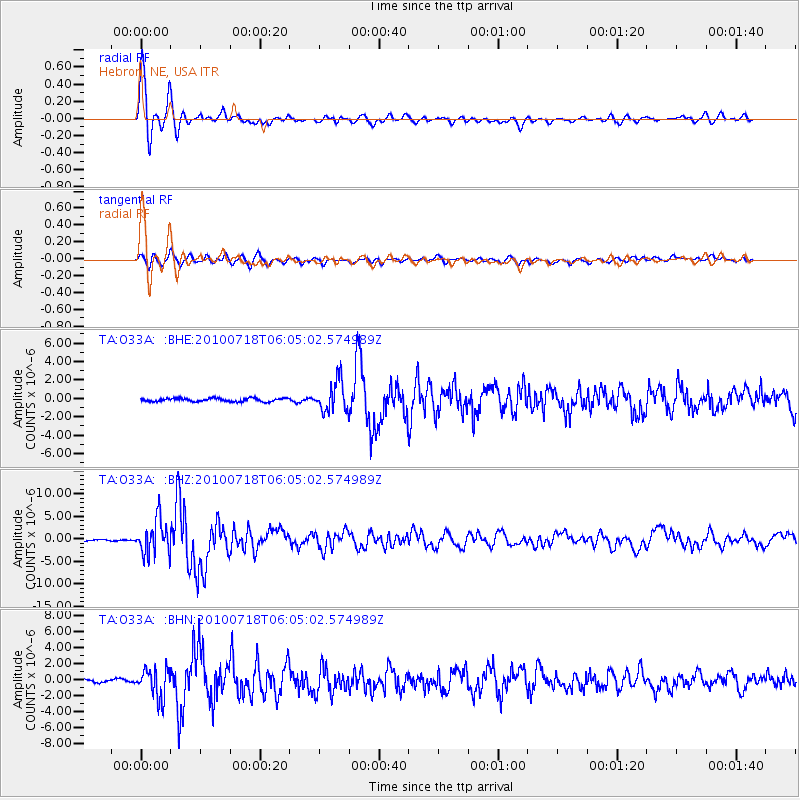
Earthquake location: Fox Islands, Aleutian Islands
Earthquake latitude/longitude: 52.9/-169.8
Earthquake time(UTC): 2010/07/18 (199) 05:56:44 GMT
Earthquake Depth: 14 km
Earthquake Magnitude: 6.3 MB, 6.7 MS, 6.6 MW, 6.6 MW
Earthquake Catalog/Contributor: WHDF/NEIC
Network: TA USArray Transportable Network (new EarthScope stations)
Station: O33A Hebron, NE, USA
Lat/Lon: 40.08 N/97.58 W
Elevation: 480 m
Distance: 49.3 deg
Az: 74.495 deg
Baz: 310.433 deg
Ray Param: 0.06876033
Estimated Moho Depth: 32.5 km
Estimated Crust Vp/Vs: 1.91
Assumed Crust Vp: 6.498 km/s
Estimated Crust Vs: 3.397 km/s
Estimated Crust Poisson's Ratio: 0.31
Radial Match: 95.97334 %
Radial Bump: 400
Transverse Match: 86.20463 %
Transverse Bump: 400
SOD ConfigId: 319893
Insert Time: 2011-01-05 06:12:09.914 +0000
GWidth: 2.5
Max Bumps: 400
Tol: 0.001

Signal To Noise

ChannelStoNSTALTA
TA:O33A: :BHZ:20100718T06:05:02.574989Z17.6453483.8022658E-62.1548261E-7
TA:O33A: :BHN:20100718T06:05:02.574989Z9.18271.8291473E-61.9919493E-7
TA:O33A: :BHE:20100718T06:05:02.574989Z9.6484531.6640809E-61.7247127E-7
Arrivals
Ps4.8 SECOND
PpPs14 SECOND
PsPs/PpSs19 SECOND