
136A Ennis, TX, USA - Earthquake Result Viewer
| ||||||||||||||||||
| ||||||||||||||||||
| ||||||||||||||||||
|
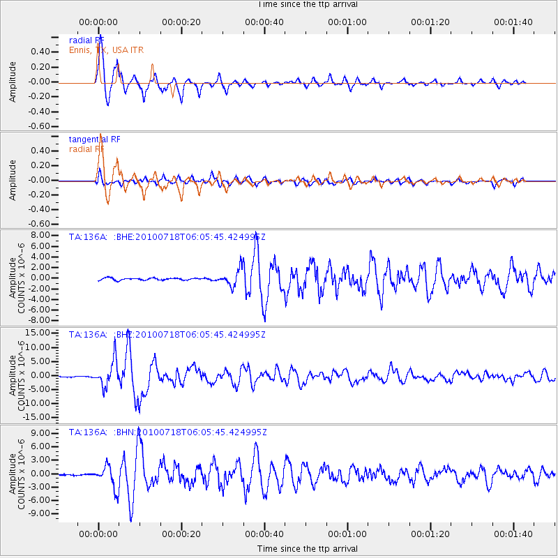
Signal To Noise
| Channel | StoN | STA | LTA |
| TA:136A: :BHZ:20100718T06:05:45.424995Z | 40.19493 | 4.737648E-6 | 1.17866804E-7 |
| TA:136A: :BHN:20100718T06:05:45.424995Z | 25.277817 | 2.6229782E-6 | 1.03766006E-7 |
| TA:136A: :BHE:20100718T06:05:45.424995Z | 8.430029 | 1.6725982E-6 | 1.9840955E-7 |
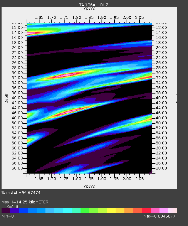
| Arrivals | |
| Ps | 1.4 SECOND |
| PpPs | 5.5 SECOND |
| PsPs/PpSs | 6.9 SECOND |

