X38A Whitesboro, OK, USA - Earthquake Result Viewer
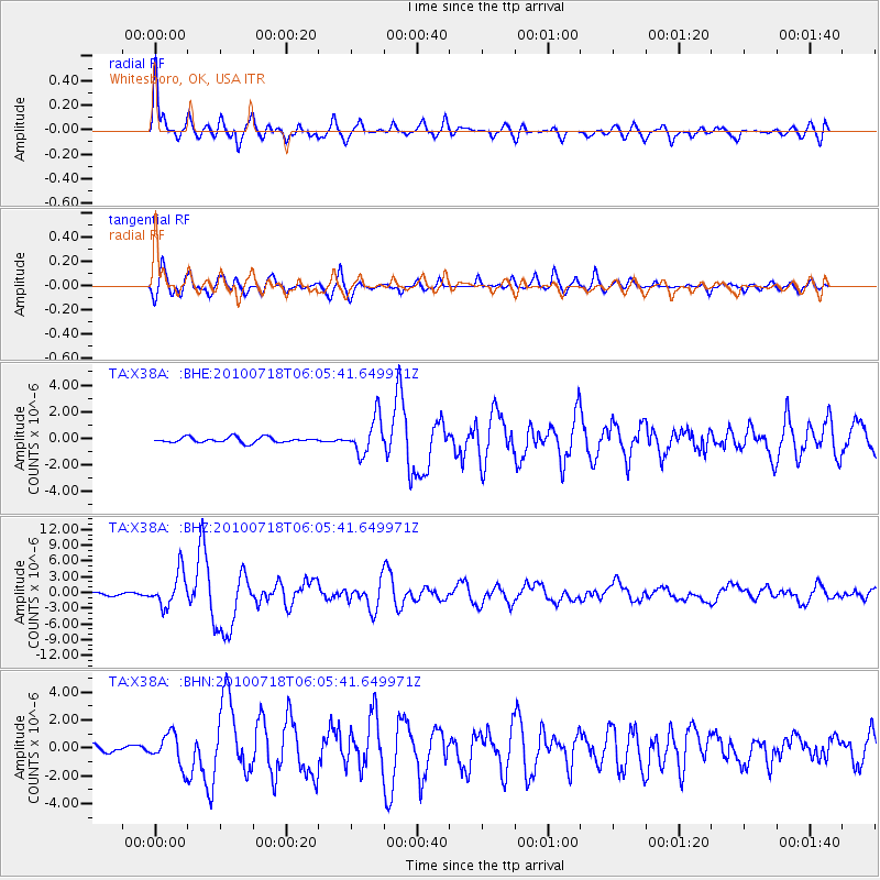
Earthquake location: Fox Islands, Aleutian Islands
Earthquake latitude/longitude: 52.9/-169.8
Earthquake time(UTC): 2010/07/18 (199) 05:56:44 GMT
Earthquake Depth: 14 km
Earthquake Magnitude: 6.3 MB, 6.7 MS, 6.6 MW, 6.6 MW
Earthquake Catalog/Contributor: WHDF/NEIC
Network: TA USArray Transportable Network (new EarthScope stations)
Station: X38A Whitesboro, OK, USA
Lat/Lon: 34.67 N/94.83 W
Elevation: 234 m
Distance: 54.6 deg
Az: 77.69 deg
Baz: 314.072 deg
Ray Param: 0.06534819
Estimated Moho Depth: 34.75 km
Estimated Crust Vp/Vs: 1.93
Assumed Crust Vp: 6.498 km/s
Estimated Crust Vs: 3.358 km/s
Estimated Crust Poisson's Ratio: 0.32
Radial Match: 91.20365 %
Radial Bump: 400
Transverse Match: 88.51582 %
Transverse Bump: 400
SOD ConfigId: 319893
Insert Time: 2011-01-05 06:13:12.783 +0000
GWidth: 2.5
Max Bumps: 400
Tol: 0.001

Signal To Noise

ChannelStoNSTALTA
TA:X38A: :BHZ:20100718T06:05:41.649971Z13.7137583.2584937E-62.3760765E-7
TA:X38A: :BHN:20100718T06:05:41.649971Z3.77350661.1384557E-63.0169699E-7
TA:X38A: :BHE:20100718T06:05:41.649971Z6.69564631.3591537E-62.0299066E-7
Arrivals
Ps5.3 SECOND
PpPs15 SECOND
PsPs/PpSs20 SECOND