
V36A Jenks, OK, USA - Earthquake Result Viewer
| ||||||||||||||||||
| ||||||||||||||||||
| ||||||||||||||||||
|
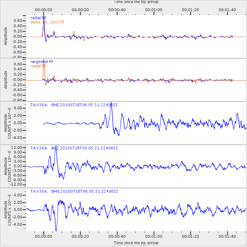
Signal To Noise
| Channel | StoN | STA | LTA |
| TA:V36A: :BHZ:20100718T06:05:31.224983Z | 12.806524 | 2.9842638E-6 | 2.3302682E-7 |
| TA:V36A: :BHN:20100718T06:05:31.224983Z | 4.5807967 | 1.1851382E-6 | 2.5871879E-7 |
| TA:V36A: :BHE:20100718T06:05:31.224983Z | 7.6133738 | 1.0539849E-6 | 1.3843861E-7 |
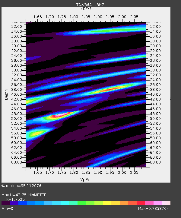
| Arrivals | |
| Ps | 5.9 SECOND |
| PpPs | 19 SECOND |
| PsPs/PpSs | 25 SECOND |

