V37A Hulbert, OK, USA - Earthquake Result Viewer
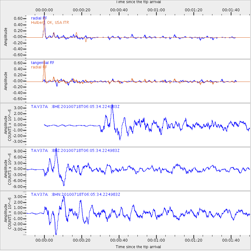
Earthquake location: Fox Islands, Aleutian Islands
Earthquake latitude/longitude: 52.9/-169.8
Earthquake time(UTC): 2010/07/18 (199) 05:56:44 GMT
Earthquake Depth: 14 km
Earthquake Magnitude: 6.3 MB, 6.7 MS, 6.6 MW, 6.6 MW
Earthquake Catalog/Contributor: WHDF/NEIC
Network: TA USArray Transportable Network (new EarthScope stations)
Station: V37A Hulbert, OK, USA
Lat/Lon: 35.88 N/95.14 W
Elevation: 219 m
Distance: 53.6 deg
Az: 76.827 deg
Baz: 313.386 deg
Ray Param: 0.06600733
Estimated Moho Depth: 38.25 km
Estimated Crust Vp/Vs: 1.82
Assumed Crust Vp: 6.498 km/s
Estimated Crust Vs: 3.565 km/s
Estimated Crust Poisson's Ratio: 0.28
Radial Match: 96.1477 %
Radial Bump: 229
Transverse Match: 91.04307 %
Transverse Bump: 400
SOD ConfigId: 319893
Insert Time: 2011-01-05 06:13:23.307 +0000
GWidth: 2.5
Max Bumps: 400
Tol: 0.001

Signal To Noise

ChannelStoNSTALTA
TA:V37A: :BHZ:20100718T06:05:34.224983Z17.038112.35037E-61.3794781E-7
TA:V37A: :BHN:20100718T06:05:34.224983Z15.3843358.9540066E-75.8202108E-8
TA:V37A: :BHE:20100718T06:05:34.224983Z12.713618.572867E-76.7430626E-8
Arrivals
Ps5.1 SECOND
PpPs16 SECOND
PsPs/PpSs21 SECOND