V38A Canehill, AR, USA - Earthquake Result Viewer
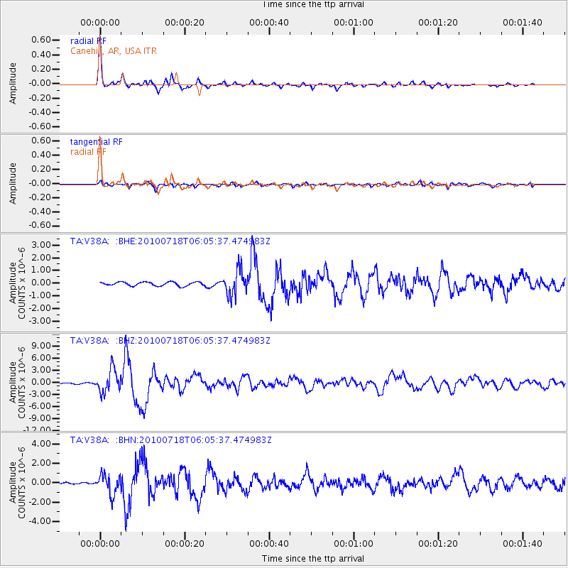
Earthquake location: Fox Islands, Aleutian Islands
Earthquake latitude/longitude: 52.9/-169.8
Earthquake time(UTC): 2010/07/18 (199) 05:56:44 GMT
Earthquake Depth: 14 km
Earthquake Magnitude: 6.3 MB, 6.7 MS, 6.6 MW, 6.6 MW
Earthquake Catalog/Contributor: WHDF/NEIC
Network: TA USArray Transportable Network (new EarthScope stations)
Station: V38A Canehill, AR, USA
Lat/Lon: 35.86 N/94.41 W
Elevation: 372 m
Distance: 54.0 deg
Az: 76.338 deg
Baz: 313.525 deg
Ray Param: 0.06570809
Estimated Moho Depth: 37.25 km
Estimated Crust Vp/Vs: 1.89
Assumed Crust Vp: 6.498 km/s
Estimated Crust Vs: 3.433 km/s
Estimated Crust Poisson's Ratio: 0.31
Radial Match: 95.383545 %
Radial Bump: 290
Transverse Match: 80.762276 %
Transverse Bump: 400
SOD ConfigId: 319893
Insert Time: 2011-01-05 06:13:34.418 +0000
GWidth: 2.5
Max Bumps: 400
Tol: 0.001

Signal To Noise

ChannelStoNSTALTA
TA:V38A: :BHZ:20100718T06:05:37.474983Z25.1652342.9338937E-61.165852E-7
TA:V38A: :BHN:20100718T06:05:37.474983Z10.5894761.0393833E-69.815248E-8
TA:V38A: :BHE:20100718T06:05:37.474983Z6.9167971.0170747E-61.4704418E-7
Arrivals
Ps5.4 SECOND
PpPs16 SECOND
PsPs/PpSs21 SECOND