U38A Gravette, AR, USA - Earthquake Result Viewer
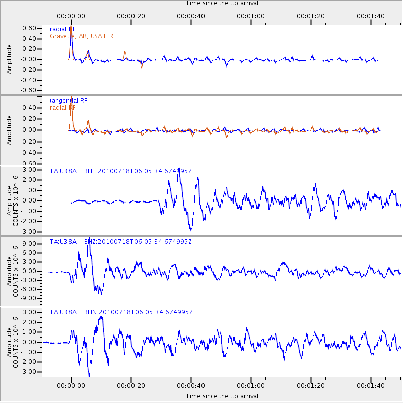
Earthquake location: Fox Islands, Aleutian Islands
Earthquake latitude/longitude: 52.9/-169.8
Earthquake time(UTC): 2010/07/18 (199) 05:56:44 GMT
Earthquake Depth: 14 km
Earthquake Magnitude: 6.3 MB, 6.7 MS, 6.6 MW, 6.6 MW
Earthquake Catalog/Contributor: WHDF/NEIC
Network: TA USArray Transportable Network (new EarthScope stations)
Station: U38A Gravette, AR, USA
Lat/Lon: 36.44 N/94.39 W
Elevation: 389 m
Distance: 53.6 deg
Az: 75.804 deg
Baz: 313.223 deg
Ray Param: 0.065964445
Estimated Moho Depth: 45.25 km
Estimated Crust Vp/Vs: 1.78
Assumed Crust Vp: 6.53 km/s
Estimated Crust Vs: 3.674 km/s
Estimated Crust Poisson's Ratio: 0.27
Radial Match: 94.76909 %
Radial Bump: 306
Transverse Match: 71.75212 %
Transverse Bump: 400
SOD ConfigId: 319893
Insert Time: 2011-01-05 06:13:47.532 +0000
GWidth: 2.5
Max Bumps: 400
Tol: 0.001

Signal To Noise

ChannelStoNSTALTA
TA:U38A: :BHZ:20100718T06:05:34.674995Z19.8530462.4481276E-61.2331243E-7
TA:U38A: :BHN:20100718T06:05:34.674995Z11.2167899.308613E-78.298821E-8
TA:U38A: :BHE:20100718T06:05:34.674995Z10.0223358.4392934E-78.4204856E-8
Arrivals
Ps5.7 SECOND
PpPs18 SECOND
PsPs/PpSs24 SECOND