
U36A Oologah, OK, USA - Earthquake Result Viewer
| ||||||||||||||||||
| ||||||||||||||||||
| ||||||||||||||||||
|
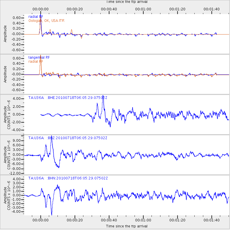
Signal To Noise
| Channel | StoN | STA | LTA |
| TA:U36A: :BHZ:20100718T06:05:29.07502Z | 18.502323 | 2.6604846E-6 | 1.4379192E-7 |
| TA:U36A: :BHN:20100718T06:05:29.07502Z | 9.604922 | 1.1685925E-6 | 1.21666E-7 |
| TA:U36A: :BHE:20100718T06:05:29.07502Z | 7.7896767 | 1.1577589E-6 | 1.4862735E-7 |
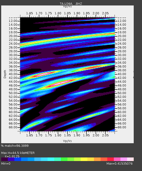
| Arrivals | |
| Ps | 5.9 SECOND |
| PpPs | 18 SECOND |
| PsPs/PpSs | 24 SECOND |

