OXF Oxford, Mississippi, USA - Earthquake Result Viewer
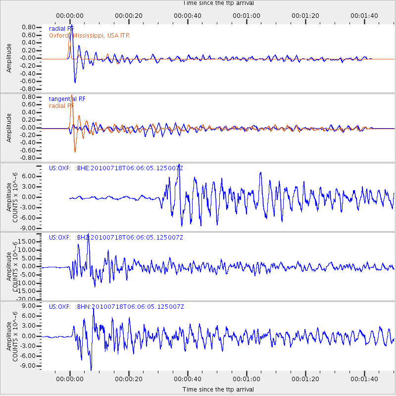
Earthquake location: Fox Islands, Aleutian Islands
Earthquake latitude/longitude: 52.9/-169.8
Earthquake time(UTC): 2010/07/18 (199) 05:56:44 GMT
Earthquake Depth: 14 km
Earthquake Magnitude: 6.3 MB, 6.7 MS, 6.6 MW, 6.6 MW
Earthquake Catalog/Contributor: WHDF/NEIC
Network: US United States National Seismic Network
Station: OXF Oxford, Mississippi, USA
Lat/Lon: 34.51 N/89.41 W
Elevation: 101 m
Distance: 57.9 deg
Az: 74.049 deg
Baz: 315.111 deg
Ray Param: 0.06320016
Estimated Moho Depth: 10.0 km
Estimated Crust Vp/Vs: 1.60
Assumed Crust Vp: 6.38 km/s
Estimated Crust Vs: 3.988 km/s
Estimated Crust Poisson's Ratio: 0.18
Radial Match: 96.28435 %
Radial Bump: 400
Transverse Match: 92.15335 %
Transverse Bump: 400
SOD ConfigId: 319893
Insert Time: 2011-01-05 06:15:15.071 +0000
GWidth: 2.5
Max Bumps: 400
Tol: 0.001

Signal To Noise

ChannelStoNSTALTA
US:OXF: :BHZ:20100718T06:06:05.125007Z37.3212475.0424296E-61.3510882E-7
US:OXF: :BHN:20100718T06:06:05.125007Z8.0014312.463808E-63.0792089E-7
US:OXF: :BHE:20100718T06:06:05.125007Z8.3729972.4688838E-62.9486262E-7
Arrivals
Ps1.0 SECOND
PpPs3.9 SECOND
PsPs/PpSs4.9 SECOND