
BLA Blacksburg, Virginia, USA - Earthquake Result Viewer
| ||||||||||||||||||
| ||||||||||||||||||
| ||||||||||||||||||
|
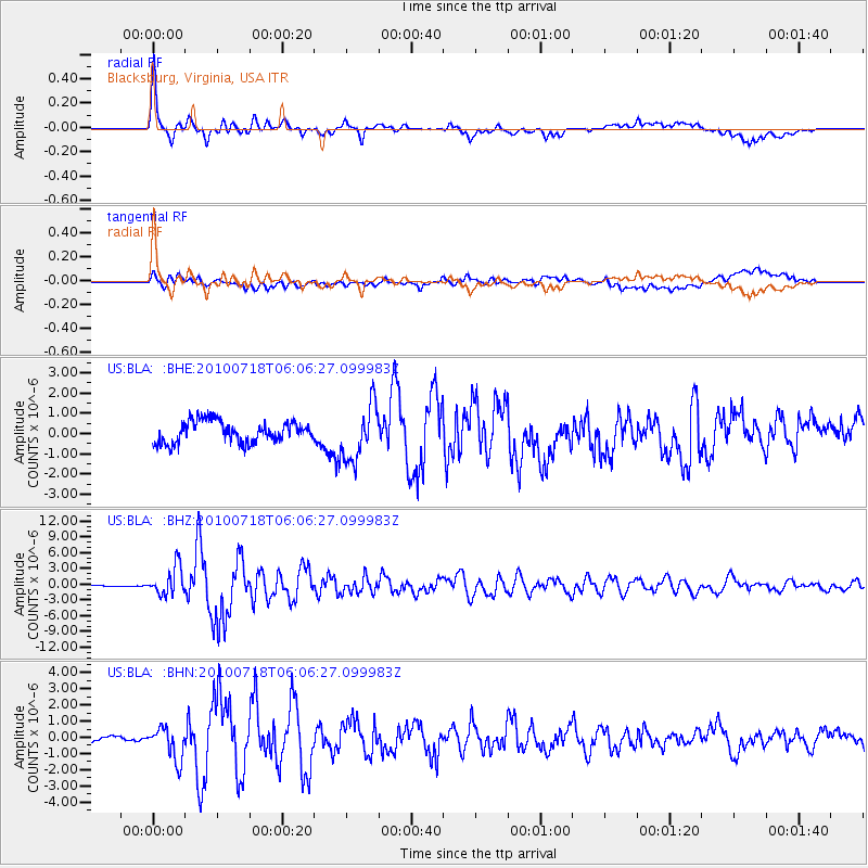
Signal To Noise
| Channel | StoN | STA | LTA |
| US:BLA: :BHZ:20100718T06:06:27.099983Z | 13.342879 | 2.7157555E-6 | 2.0353595E-7 |
| US:BLA: :BHN:20100718T06:06:27.099983Z | 6.8196454 | 1.0159242E-6 | 1.4897024E-7 |
| US:BLA: :BHE:20100718T06:06:27.099983Z | 2.6094792 | 1.3671944E-6 | 5.239338E-7 |
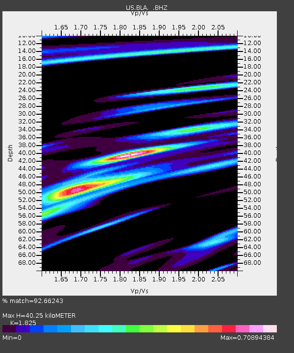
| Arrivals | |
| Ps | 5.6 SECOND |
| PpPs | 18 SECOND |
| PsPs/PpSs | 23 SECOND |

