TZTN Tazewell, Tennessee, USA - Earthquake Result Viewer
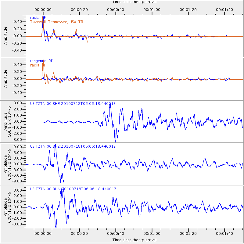
Earthquake location: Fox Islands, Aleutian Islands
Earthquake latitude/longitude: 52.9/-169.8
Earthquake time(UTC): 2010/07/18 (199) 05:56:44 GMT
Earthquake Depth: 14 km
Earthquake Magnitude: 6.3 MB, 6.7 MS, 6.6 MW, 6.6 MW
Earthquake Catalog/Contributor: WHDF/NEIC
Network: US United States National Seismic Network
Station: TZTN Tazewell, Tennessee, USA
Lat/Lon: 36.54 N/83.55 W
Elevation: 394 m
Distance: 59.8 deg
Az: 68.411 deg
Baz: 315.585 deg
Ray Param: 0.06194288
Estimated Moho Depth: 43.25 km
Estimated Crust Vp/Vs: 1.83
Assumed Crust Vp: 6.476 km/s
Estimated Crust Vs: 3.534 km/s
Estimated Crust Poisson's Ratio: 0.29
Radial Match: 92.79458 %
Radial Bump: 400
Transverse Match: 78.28068 %
Transverse Bump: 400
SOD ConfigId: 319893
Insert Time: 2011-01-05 06:17:45.199 +0000
GWidth: 2.5
Max Bumps: 400
Tol: 0.001

Signal To Noise

ChannelStoNSTALTA
US:TZTN:00:BHZ:20100718T06:06:18.44001Z17.610922.5322427E-61.4378821E-7
US:TZTN:00:BHN:20100718T06:06:18.44001Z7.694847.5587417E-79.8231304E-8
US:TZTN:00:BHE:20100718T06:06:18.44001Z7.40389827.31568E-79.8808485E-8
Arrivals
Ps5.8 SECOND
PpPs18 SECOND
PsPs/PpSs24 SECOND