
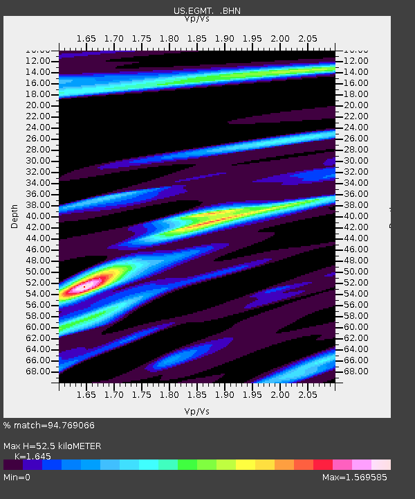
EGMT Eagleton, Montana, USA - Earthquake Result Viewer
| ||||||||||||||||||
| ||||||||||||||||||
| ||||||||||||||||||
|
Signal To Noise
| Channel | StoN | STA | LTA |
| US:EGMT: :BHZ:20100718T06:03:28.100013Z | 53.152172 | 4.78309E-6 | 8.99886E-8 |
| US:EGMT: :BHN:20100718T06:03:28.100013Z | 6.4700394 | 1.3156802E-6 | 2.0334963E-7 |
| US:EGMT: :BHE:20100718T06:03:28.100013Z | 10.188763 | 2.0620735E-6 | 2.0238703E-7 |
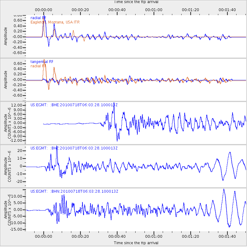
| Arrivals | |
| Ps | 5.7 SECOND |
| PpPs | 20 SECOND |
| PsPs/PpSs | 26 SECOND |

