BFS Mt Baldy Forest Station - Earthquake Result Viewer
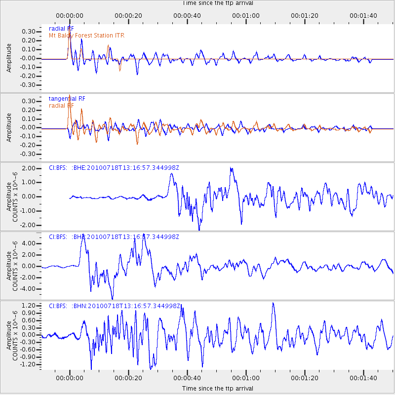
Earthquake location: New Britain Region, P.N.G.
Earthquake latitude/longitude: -6.0/150.4
Earthquake time(UTC): 2010/07/18 (199) 13:04:09 GMT
Earthquake Depth: 28 km
Earthquake Magnitude: 6.3 MB, 7.1 MS, 6.9 MW, 6.8 MW
Earthquake Catalog/Contributor: WHDF/NEIC
Network: CI Caltech Regional Seismic Network
Station: BFS Mt Baldy Forest Station
Lat/Lon: 34.24 N/117.66 W
Elevation: 1312 m
Distance: 94.9 deg
Az: 56.204 deg
Baz: 266.148 deg
Ray Param: 0.040915202
Estimated Moho Depth: 24.5 km
Estimated Crust Vp/Vs: 2.05
Assumed Crust Vp: 6.276 km/s
Estimated Crust Vs: 3.069 km/s
Estimated Crust Poisson's Ratio: 0.34
Radial Match: 89.61415 %
Radial Bump: 400
Transverse Match: 83.04082 %
Transverse Bump: 400
SOD ConfigId: 319893
Insert Time: 2011-01-05 06:30:23.217 +0000
GWidth: 2.5
Max Bumps: 400
Tol: 0.001

Signal To Noise

ChannelStoNSTALTA
CI:BFS: :BHZ:20100718T13:16:57.344998Z15.6680232.2469749E-61.434115E-7
CI:BFS: :BHN:20100718T13:16:57.344998Z2.52882311.9459429E-77.6950535E-8
CI:BFS: :BHE:20100718T13:16:57.344998Z11.5856766.4490155E-75.5663698E-8
Arrivals
Ps4.1 SECOND
PpPs12 SECOND
PsPs/PpSs16 SECOND