MUR Murrieta - Earthquake Result Viewer
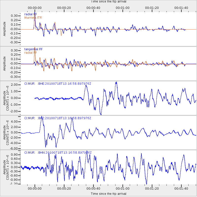
Earthquake location: New Britain Region, P.N.G.
Earthquake latitude/longitude: -6.0/150.4
Earthquake time(UTC): 2010/07/18 (199) 13:04:09 GMT
Earthquake Depth: 28 km
Earthquake Magnitude: 6.3 MB, 7.1 MS, 6.9 MW, 6.8 MW
Earthquake Catalog/Contributor: WHDF/NEIC
Network: CI Caltech Regional Seismic Network
Station: MUR Murrieta
Lat/Lon: 33.60 N/117.20 W
Elevation: 562 m
Distance: 95.2 deg
Az: 56.867 deg
Baz: 266.346 deg
Ray Param: 0.040824257
Estimated Moho Depth: 10.75 km
Estimated Crust Vp/Vs: 1.88
Assumed Crust Vp: 6.264 km/s
Estimated Crust Vs: 3.341 km/s
Estimated Crust Poisson's Ratio: 0.30
Radial Match: 92.420876 %
Radial Bump: 400
Transverse Match: 85.643265 %
Transverse Bump: 400
SOD ConfigId: 319893
Insert Time: 2011-01-05 06:31:08.777 +0000
GWidth: 2.5
Max Bumps: 400
Tol: 0.001

Signal To Noise

ChannelStoNSTALTA
CI:MUR: :BHZ:20100718T13:16:58.897976Z17.1771472.1796438E-61.2689208E-7
CI:MUR: :BHN:20100718T13:16:58.897976Z0.60074047.084788E-81.17934285E-7
CI:MUR: :BHE:20100718T13:16:58.897976Z8.0845636.501185E-78.04148E-8
Arrivals
Ps1.5 SECOND
PpPs4.8 SECOND
PsPs/PpSs6.4 SECOND