
INU Inuyama, Japan - Earthquake Result Viewer
| ||||||||||||||||||
| ||||||||||||||||||
| ||||||||||||||||||
|
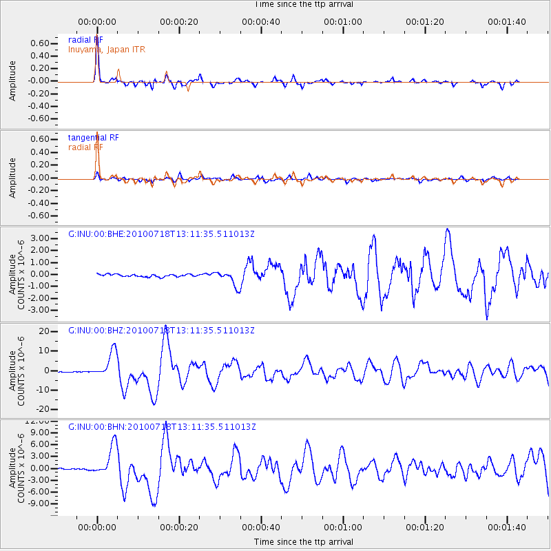
Signal To Noise
| Channel | StoN | STA | LTA |
| G:INU:00:BHZ:20100718T13:11:35.511013Z | 61.085682 | 7.24543E-6 | 1.1861094E-7 |
| G:INU:00:BHN:20100718T13:11:35.511013Z | 23.090057 | 4.142828E-6 | 1.7942043E-7 |
| G:INU:00:BHE:20100718T13:11:35.511013Z | 6.4576597 | 6.626059E-7 | 1.02607736E-7 |
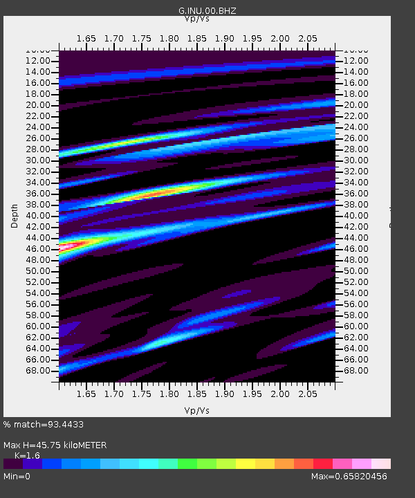
| Arrivals | |
| Ps | 4.6 SECOND |
| PpPs | 17 SECOND |
| PsPs/PpSs | 22 SECOND |

