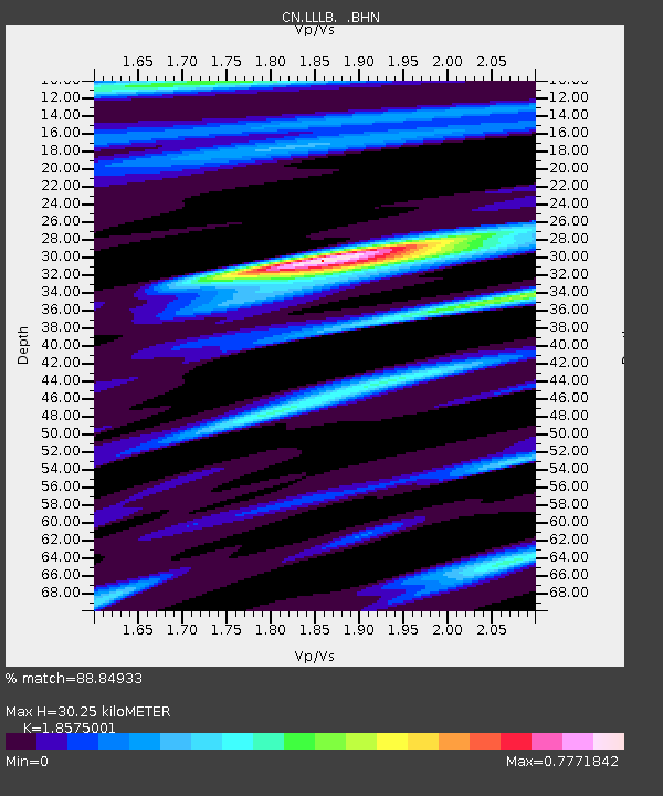
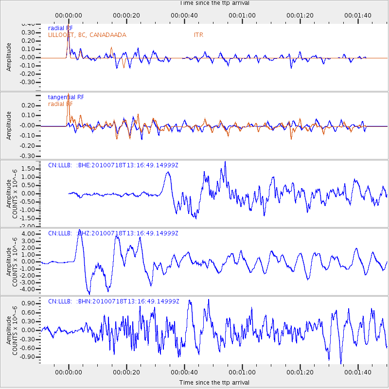
LLLB LILLOOET, BC, CANADA ADA - Earthquake Result Viewer

Earthquake location: New Britain Region, P.N.G.
Earthquake latitude/longitude: -6.0/150.4
Earthquake time(UTC): 2010/07/18 (199) 13:04:09 GMT
Earthquake Depth: 28 km
Earthquake Magnitude: 6.3 MB, 7.1 MS, 6.9 MW, 6.8 MW
Earthquake Catalog/Contributor: WHDF/NEIC
Network: CN Canadian National Seismograph Network
Station: LLLB LILLOOET, BC, CANADA ADA
Lat/Lon: 50.61 N/121.88 W
Elevation: 700 m
Distance: 93.1 deg
Az: 39.611 deg
Baz: 264.444 deg
Ray Param: 0.041319594
Estimated Moho Depth: 30.25 km
Estimated Crust Vp/Vs: 1.86
Assumed Crust Vp: 6.597 km/s
Estimated Crust Vs: 3.552 km/s
Estimated Crust Poisson's Ratio: 0.30
Radial Match: 88.84933 %
Radial Bump: 398
Transverse Match: 80.92595 %
Transverse Bump: 400
SOD ConfigId: 319893
Insert Time: 2011-01-05 06:32:01.074 +0000
GWidth: 2.5
Max Bumps: 400
Tol: 0.001

Signal To Noise

ChannelStoNSTALTA
CN:LLLB: :BHZ:20100718T13:16:49.14999Z21.0200672.3766192E-61.130643E-7
CN:LLLB: :BHN:20100718T13:16:49.14999Z0.82526335.1733704E-86.268751E-8
CN:LLLB: :BHE:20100718T13:16:49.14999Z10.8689376.8971497E-76.345745E-8
Arrivals
Ps4.0 SECOND
PpPs13 SECOND
PsPs/PpSs17 SECOND