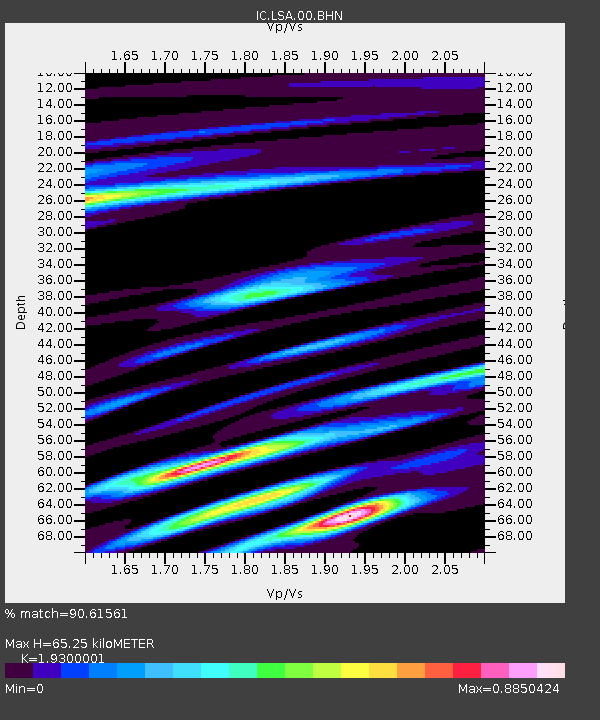
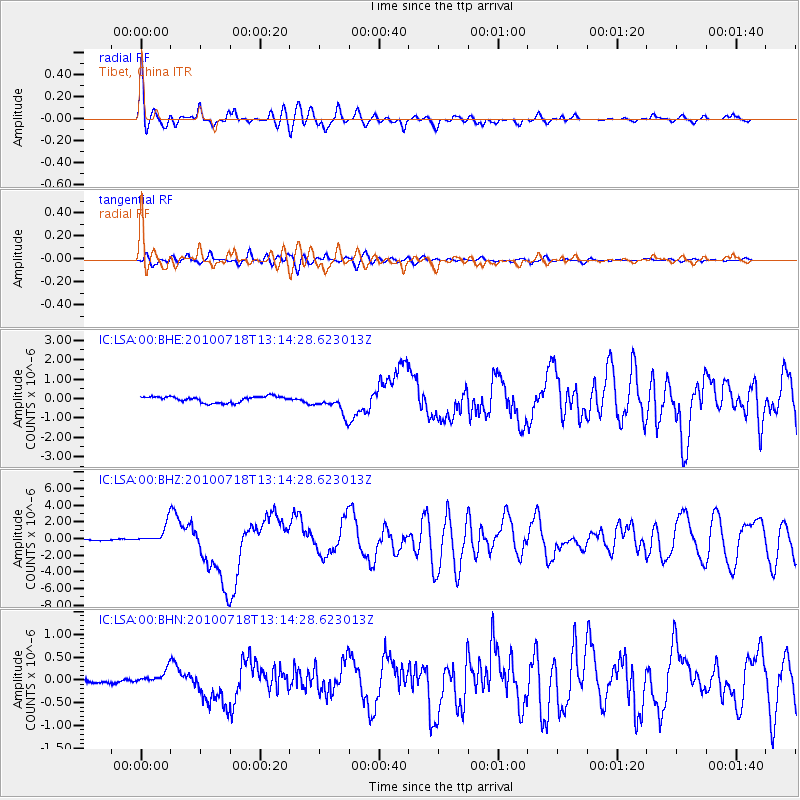
LSA Tibet, China - Earthquake Result Viewer

Earthquake location: New Britain Region, P.N.G.
Earthquake latitude/longitude: -6.0/150.4
Earthquake time(UTC): 2010/07/18 (199) 13:04:09 GMT
Earthquake Depth: 28 km
Earthquake Magnitude: 6.3 MB, 7.1 MS, 6.9 MW, 6.8 MW
Earthquake Catalog/Contributor: WHDF/NEIC
Network: IC New China Digital Seismograph Network
Station: LSA Tibet, China
Lat/Lon: 29.70 N/91.15 E
Elevation: 3789 m
Distance: 67.0 deg
Az: 305.637 deg
Baz: 111.703 deg
Ray Param: 0.057222072
Estimated Moho Depth: 65.25 km
Estimated Crust Vp/Vs: 1.93
Assumed Crust Vp: 6.514 km/s
Estimated Crust Vs: 3.375 km/s
Estimated Crust Poisson's Ratio: 0.32
Radial Match: 90.61561 %
Radial Bump: 400
Transverse Match: 88.91601 %
Transverse Bump: 400
SOD ConfigId: 319893
Insert Time: 2011-01-05 06:32:37.419 +0000
GWidth: 2.5
Max Bumps: 400
Tol: 0.001

Signal To Noise

ChannelStoNSTALTA
IC:LSA:00:BHZ:20100718T13:14:28.623013Z19.2407531.230193E-66.3936845E-8
IC:LSA:00:BHN:20100718T13:14:28.623013Z5.1154081.5830574E-73.0946843E-8
IC:LSA:00:BHE:20100718T13:14:28.623013Z3.18454484.897348E-71.5378487E-7
Arrivals
Ps9.7 SECOND
PpPs28 SECOND
PsPs/PpSs38 SECOND