MIDW Midway Island, USA - Earthquake Result Viewer
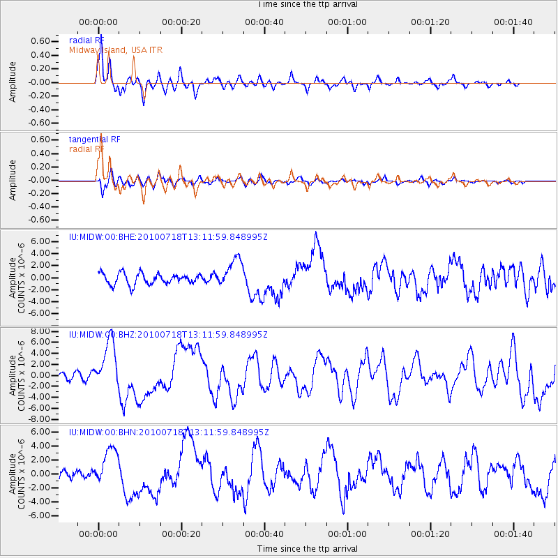
Earthquake location: New Britain Region, P.N.G.
Earthquake latitude/longitude: -6.0/150.4
Earthquake time(UTC): 2010/07/18 (199) 13:04:09 GMT
Earthquake Depth: 28 km
Earthquake Magnitude: 6.3 MB, 7.1 MS, 6.9 MW, 6.8 MW
Earthquake Catalog/Contributor: WHDF/NEIC
Network: IU Global Seismograph Network (GSN - IRIS/USGS)
Station: MIDW Midway Island, USA
Lat/Lon: 28.22 N/177.37 W
Elevation: 20 m
Distance: 46.0 deg
Az: 40.796 deg
Baz: 227.426 deg
Ray Param: 0.07084388
Estimated Moho Depth: 11.25 km
Estimated Crust Vp/Vs: 2.10
Assumed Crust Vp: 4.24 km/s
Estimated Crust Vs: 2.024 km/s
Estimated Crust Poisson's Ratio: 0.35
Radial Match: 91.8544 %
Radial Bump: 400
Transverse Match: 71.74413 %
Transverse Bump: 400
SOD ConfigId: 319893
Insert Time: 2011-01-05 06:33:47.026 +0000
GWidth: 2.5
Max Bumps: 400
Tol: 0.001

Signal To Noise

ChannelStoNSTALTA
IU:MIDW:00:BHZ:20100718T13:11:59.848995Z6.8101684.5401953E-66.666789E-7
IU:MIDW:00:BHN:20100718T13:11:59.848995Z3.21316462.7717347E-68.6261826E-7
IU:MIDW:00:BHE:20100718T13:11:59.848995Z2.76053572.5242773E-69.144158E-7
Arrivals
Ps3.0 SECOND
PpPs8.0 SECOND
PsPs/PpSs11 SECOND