SBA Scott Base, Antarctica - Earthquake Result Viewer
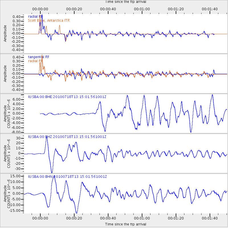
Earthquake location: New Britain Region, P.N.G.
Earthquake latitude/longitude: -6.0/150.4
Earthquake time(UTC): 2010/07/18 (199) 13:04:09 GMT
Earthquake Depth: 28 km
Earthquake Magnitude: 6.3 MB, 7.1 MS, 6.9 MW, 6.8 MW
Earthquake Catalog/Contributor: WHDF/NEIC
Network: IU Global Seismograph Network (GSN - IRIS/USGS)
Station: SBA Scott Base, Antarctica
Lat/Lon: 77.85 S/166.76 E
Elevation: 50 m
Distance: 72.4 deg
Az: 176.417 deg
Baz: 342.935 deg
Ray Param: 0.053677376
Estimated Moho Depth: 13.75 km
Estimated Crust Vp/Vs: 1.60
Assumed Crust Vp: 6.183 km/s
Estimated Crust Vs: 3.864 km/s
Estimated Crust Poisson's Ratio: 0.18
Radial Match: 96.112076 %
Radial Bump: 282
Transverse Match: 86.291435 %
Transverse Bump: 400
SOD ConfigId: 319893
Insert Time: 2011-01-05 06:33:56.853 +0000
GWidth: 2.5
Max Bumps: 400
Tol: 0.001

Signal To Noise

ChannelStoNSTALTA
IU:SBA:00:BHZ:20100718T13:15:01.561001Z60.0546041.4225975E-52.36884E-7
IU:SBA:00:BHN:20100718T13:15:01.561001Z10.28558354.9580863E-64.8204225E-7
IU:SBA:00:BHE:20100718T13:15:01.561001Z5.93139171.5713241E-62.6491662E-7
Arrivals
Ps1.4 SECOND
PpPs5.6 SECOND
PsPs/PpSs7.0 SECOND