
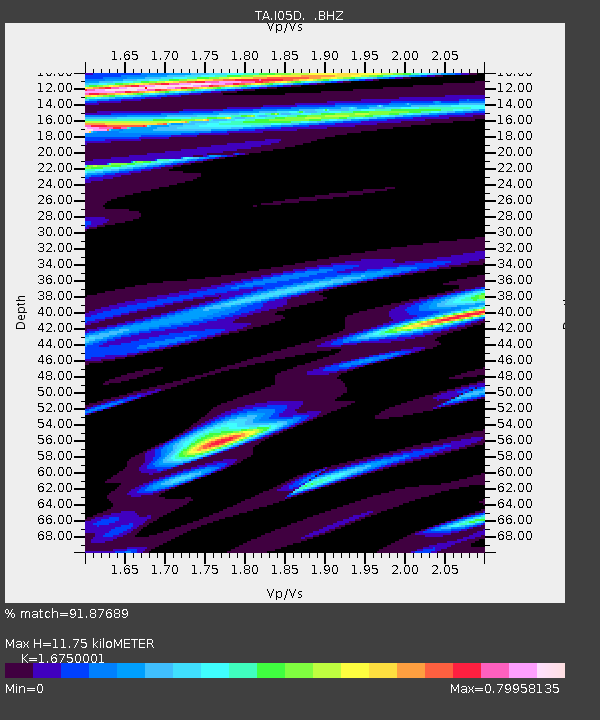
I05D Terrebonne, OR, USA - Earthquake Result Viewer
| ||||||||||||||||||
| ||||||||||||||||||
| ||||||||||||||||||
|
Signal To Noise
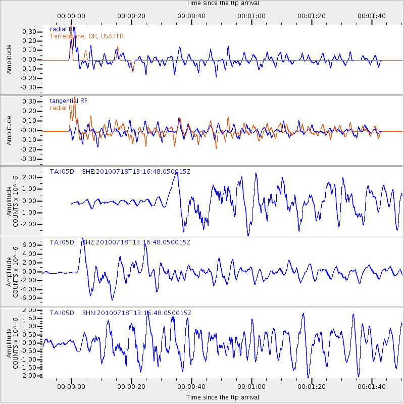
| Channel | StoN | STA | LTA |
| TA:I05D: :BHZ:20100718T13:16:48.050015Z | 21.085918 | 3.5837688E-6 | 1.699603E-7 |
| TA:I05D: :BHN:20100718T13:16:48.050015Z | 1.5703259 | 3.3528502E-7 | 2.1351303E-7 |
| TA:I05D: :BHE:20100718T13:16:48.050015Z | 7.20703 | 1.1101164E-6 | 1.5403245E-7 |
| Arrivals | |
| Ps | 1.2 SECOND |
| PpPs | 4.7 SECOND |
| PsPs/PpSs | 5.9 SECOND |

