You are here: Home > Network List > US - United States National Seismic Network Stations List
> Station HAWA Hanford, Washington, USA > Earthquake Result Viewer
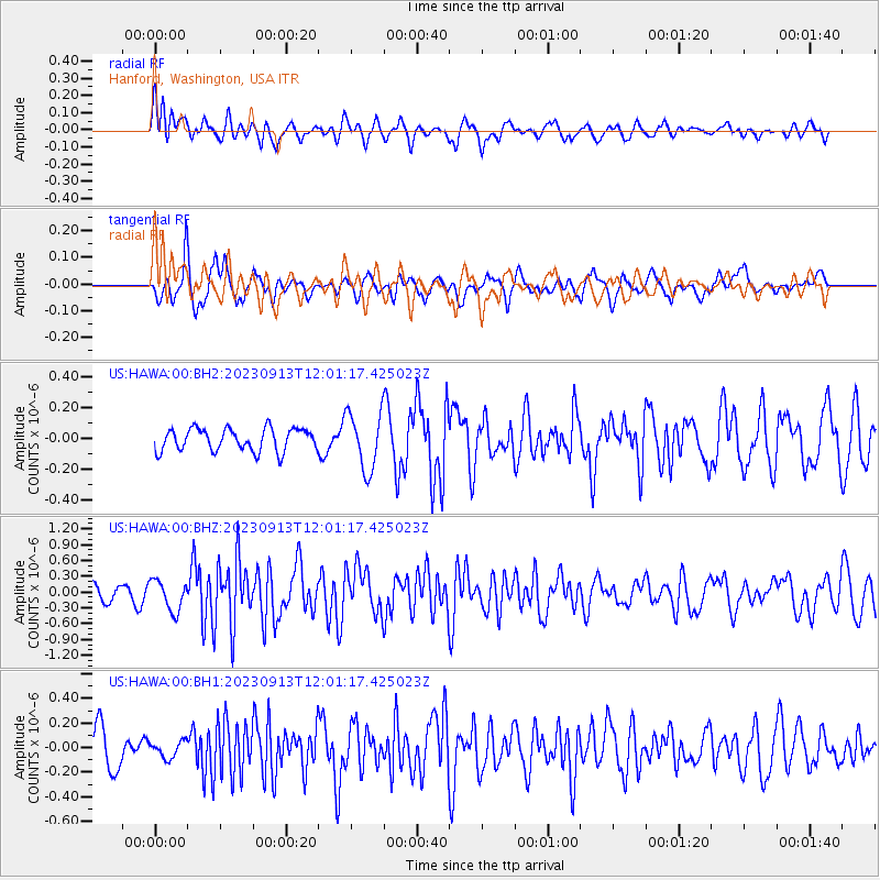
HAWA Hanford, Washington, USA - Earthquake Result Viewer
*The percent match for this event was below the threshold and hence no stack was calculated.
| Earthquake location: |
West Chile Rise |
| Earthquake latitude/longitude: |
-36.2/-97.9 |
| Earthquake time(UTC): |
2023/09/13 (256) 11:49:15 GMT |
| Earthquake Depth: |
10 km |
| Earthquake Magnitude: |
6.1 mww |
| Earthquake Catalog/Contributor: |
NEIC PDE/us |
|
| Network: |
US United States National Seismic Network |
| Station: |
HAWA Hanford, Washington, USA |
| Lat/Lon: |
46.39 N/119.53 W |
| Elevation: |
364 m |
|
| Distance: |
84.5 deg |
| Az: |
345.172 deg |
| Baz: |
162.603 deg |
| Ray Param: |
$rayparam |
*The percent match for this event was below the threshold and hence was not used in the summary stack. |
|
| Radial Match: |
65.419975 % |
| Radial Bump: |
400 |
| Transverse Match: |
67.5475 % |
| Transverse Bump: |
400 |
| SOD ConfigId: |
31937991 |
| Insert Time: |
2023-09-27 12:12:04.366 +0000 |
| GWidth: |
2.5 |
| Max Bumps: |
400 |
| Tol: |
0.001 |
|
Signal To Noise
| Channel | StoN | STA | LTA |
| US:HAWA:00:BHZ:20230913T12:01:17.425023Z | 2.6353197 | 2.8750864E-7 | 1.09098195E-7 |
| US:HAWA:00:BH1:20230913T12:01:17.425023Z | 0.49432495 | 6.668009E-8 | 1.348912E-7 |
| US:HAWA:00:BH2:20230913T12:01:17.425023Z | 2.5491936 | 1.8583654E-7 | 7.290013E-8 |
| Arrivals |
| Ps | |
| PpPs | |
| PsPs/PpSs | |


