You are here: Home > Network List > UW - Pacific Northwest Regional Seismic Network Stations List
> Station FISH Seaside, OR, USA > Earthquake Result Viewer
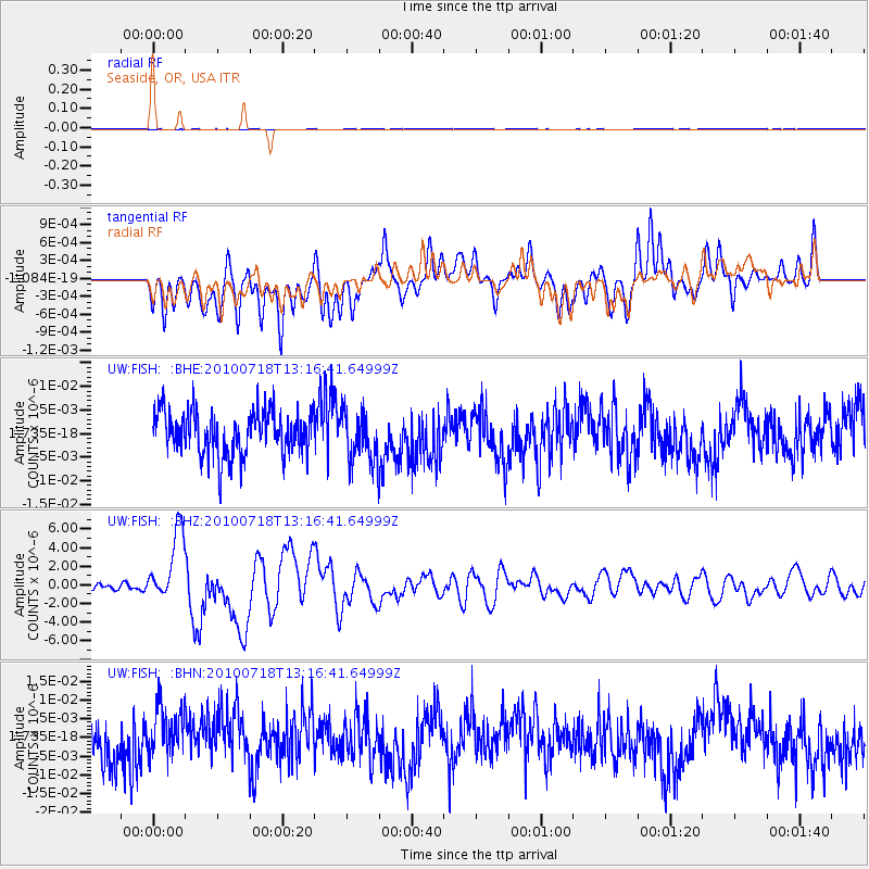
FISH Seaside, OR, USA - Earthquake Result Viewer
*The percent match for this event was below the threshold and hence no stack was calculated.
| Earthquake location: |
New Britain Region, P.N.G. |
| Earthquake latitude/longitude: |
-6.0/150.4 |
| Earthquake time(UTC): |
2010/07/18 (199) 13:04:09 GMT |
| Earthquake Depth: |
28 km |
| Earthquake Magnitude: |
6.3 MB, 7.1 MS, 6.9 MW, 6.8 MW |
| Earthquake Catalog/Contributor: |
WHDF/NEIC |
|
| Network: |
UW Pacific Northwest Regional Seismic Network |
| Station: |
FISH Seaside, OR, USA |
| Lat/Lon: |
45.93 N/123.56 W |
| Elevation: |
325 m |
|
| Distance: |
91.5 deg |
| Az: |
44.145 deg |
| Baz: |
263.014 deg |
| Ray Param: |
$rayparam |
*The percent match for this event was below the threshold and hence was not used in the summary stack. |
|
| Radial Match: |
52.00976 % |
| Radial Bump: |
400 |
| Transverse Match: |
56.762135 % |
| Transverse Bump: |
400 |
| SOD ConfigId: |
319893 |
| Insert Time: |
2011-01-05 06:39:19.980 +0000 |
| GWidth: |
2.5 |
| Max Bumps: |
400 |
| Tol: |
0.001 |
|
Signal To Noise
| Channel | StoN | STA | LTA |
| UW:FISH: :BHZ:20100718T13:16:41.64999Z | 15.590355 | 3.7991442E-6 | 2.4368555E-7 |
| UW:FISH: :BHN:20100718T13:16:41.64999Z | 1.1526794 | 7.1826367E-9 | 6.2312524E-9 |
| UW:FISH: :BHE:20100718T13:16:41.64999Z | 1.1259041 | 5.277007E-9 | 4.6869064E-9 |
| Arrivals |
| Ps | |
| PpPs | |
| PsPs/PpSs | |


