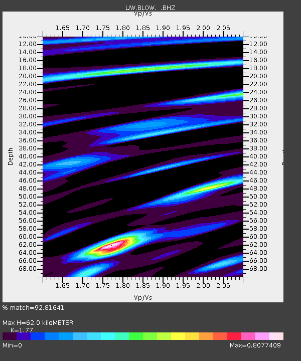
BLOW Detroit Lake, OR, USA - Earthquake Result Viewer
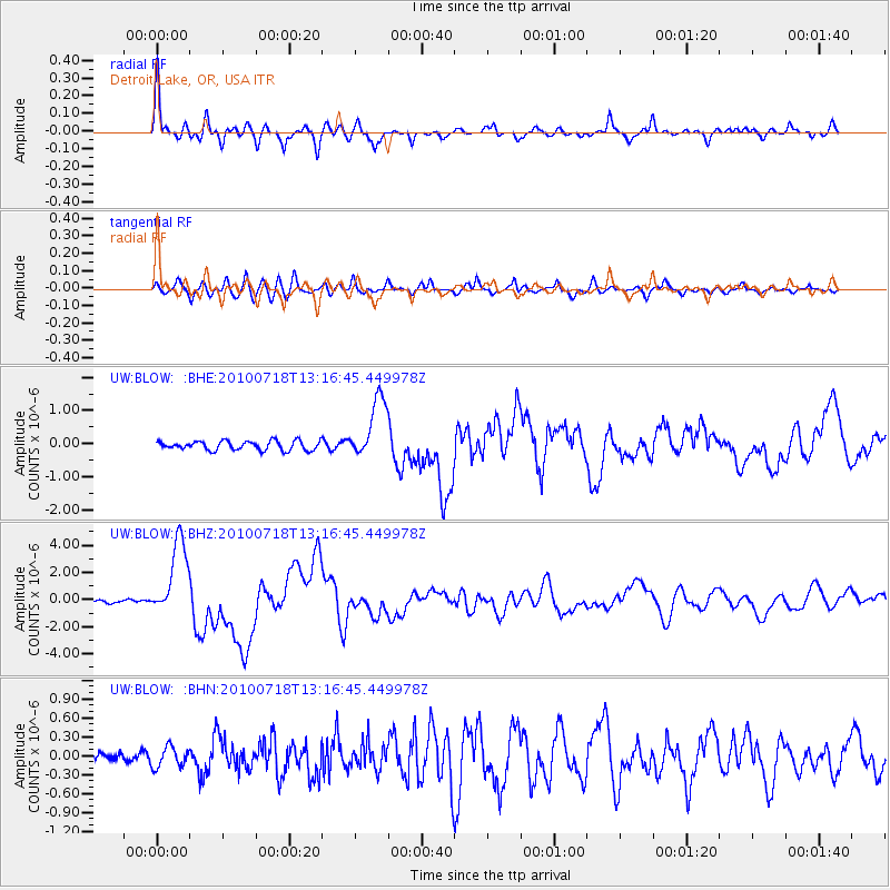
Earthquake location: New Britain Region, P.N.G.
Earthquake latitude/longitude: -6.0/150.4
Earthquake time(UTC): 2010/07/18 (199) 13:04:09 GMT
Earthquake Depth: 28 km
Earthquake Magnitude: 6.3 MB, 7.1 MS, 6.9 MW, 6.8 MW
Earthquake Catalog/Contributor: WHDF/NEIC
Network: UW Pacific Northwest Regional Seismic Network
Station: BLOW Detroit Lake, OR, USA
Lat/Lon: 44.68 N/122.19 W
Elevation: 652 m
Distance: 92.3 deg
Az: 45.495 deg
Baz: 263.942 deg
Ray Param: 0.041473802
Estimated Moho Depth: 62.0 km
Estimated Crust Vp/Vs: 1.77
Assumed Crust Vp: 6.566 km/s
Estimated Crust Vs: 3.71 km/s
Estimated Crust Poisson's Ratio: 0.27
Radial Match: 92.81641 %
Radial Bump: 400
Transverse Match: 87.782776 %
Transverse Bump: 400
SOD ConfigId: 319893
Insert Time: 2011-01-05 06:39:44.679 +0000
GWidth: 2.5
Max Bumps: 400
Tol: 0.001

Signal To Noise

ChannelStoNSTALTA
UW:BLOW: :BHZ:20100718T13:16:45.449978Z37.9614872.84823E-67.502946E-8
UW:BLOW: :BHN:20100718T13:16:45.449978Z2.70093581.6021119E-75.9316918E-8
UW:BLOW: :BHE:20100718T13:16:45.449978Z6.6637849.2841077E-71.3932186E-7
Arrivals
Ps7.4 SECOND
PpPs26 SECOND
PsPs/PpSs33 SECOND