UMAT Pilot Rock, OR, USA - Earthquake Result Viewer
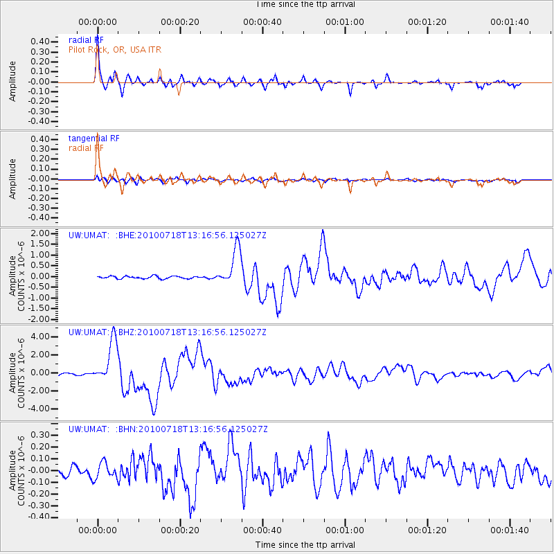
Earthquake location: New Britain Region, P.N.G.
Earthquake latitude/longitude: -6.0/150.4
Earthquake time(UTC): 2010/07/18 (199) 13:04:09 GMT
Earthquake Depth: 28 km
Earthquake Magnitude: 6.3 MB, 7.1 MS, 6.9 MW, 6.8 MW
Earthquake Catalog/Contributor: WHDF/NEIC
Network: UW Pacific Northwest Regional Seismic Network
Station: UMAT Pilot Rock, OR, USA
Lat/Lon: 45.29 N/118.96 W
Elevation: 1318 m
Distance: 94.6 deg
Az: 45.086 deg
Baz: 266.241 deg
Ray Param: 0.040986966
Estimated Moho Depth: 29.5 km
Estimated Crust Vp/Vs: 1.90
Assumed Crust Vp: 6.571 km/s
Estimated Crust Vs: 3.463 km/s
Estimated Crust Poisson's Ratio: 0.31
Radial Match: 95.66307 %
Radial Bump: 324
Transverse Match: 81.48476 %
Transverse Bump: 400
SOD ConfigId: 319893
Insert Time: 2011-01-05 06:39:46.277 +0000
GWidth: 2.5
Max Bumps: 400
Tol: 0.001

Signal To Noise

ChannelStoNSTALTA
UW:UMAT: :BHZ:20100718T13:16:56.125027Z20.7022782.4921942E-61.2038261E-7
UW:UMAT: :BHN:20100718T13:16:56.125027Z1.73742586.593817E-83.7951644E-8
UW:UMAT: :BHE:20100718T13:16:56.125027Z15.6390499.0733E-75.8016955E-8
Arrivals
Ps4.1 SECOND
PpPs13 SECOND
PsPs/PpSs17 SECOND