SMER AZ.SMER - Earthquake Result Viewer
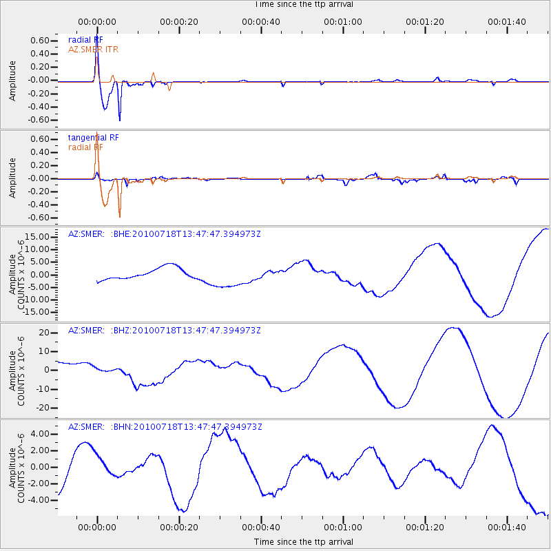
Earthquake location: New Britain Region, P.N.G.
Earthquake latitude/longitude: -5.9/150.6
Earthquake time(UTC): 2010/07/18 (199) 13:34:59 GMT
Earthquake Depth: 35 km
Earthquake Magnitude: 6.1 MB, 7.3 MS, 7.3 MW, 7.3 MW
Earthquake Catalog/Contributor: WHDF/NEIC
Network: AZ ANZA Regional Network
Station: SMER AZ.SMER
Lat/Lon: 33.46 N/117.17 W
Elevation: 355 m
Distance: 95.1 deg
Az: 57.0 deg
Baz: 266.288 deg
Ray Param: 0.040857464
Estimated Moho Depth: 11.25 km
Estimated Crust Vp/Vs: 1.60
Assumed Crust Vp: 6.264 km/s
Estimated Crust Vs: 3.915 km/s
Estimated Crust Poisson's Ratio: 0.18
Radial Match: 97.00641 %
Radial Bump: 274
Transverse Match: 76.52417 %
Transverse Bump: 400
SOD ConfigId: 319893
Insert Time: 2011-01-05 06:43:35.135 +0000
GWidth: 2.5
Max Bumps: 400
Tol: 0.001

Signal To Noise

ChannelStoNSTALTA
AZ:SMER: :BHZ:20100718T13:47:47.394973Z0.347656131.0501225E-63.020578E-6
AZ:SMER: :BHN:20100718T13:47:47.394973Z0.525004271.4557473E-62.7728297E-6
AZ:SMER: :BHE:20100718T13:47:47.394973Z2.23565864.983306E-62.22901E-6
Arrivals
Ps1.1 SECOND
PpPs4.6 SECOND
PsPs/PpSs5.7 SECOND