You are here: Home > Network List > CI - Caltech Regional Seismic Network Stations List
> Station CWC Cottonwood Creek, Lone Pine, CA, USA > Earthquake Result Viewer
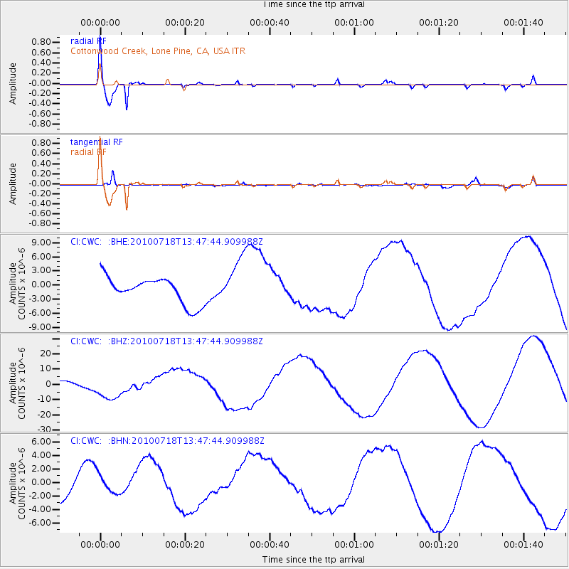
CWC Cottonwood Creek, Lone Pine, CA, USA - Earthquake Result Viewer

| Earthquake location: |
New Britain Region, P.N.G. |
| Earthquake latitude/longitude: |
-5.9/150.6 |
| Earthquake time(UTC): |
2010/07/18 (199) 13:34:59 GMT |
| Earthquake Depth: |
35 km |
| Earthquake Magnitude: |
6.1 MB, 7.3 MS, 7.3 MW, 7.3 MW |
| Earthquake Catalog/Contributor: |
WHDF/NEIC |
|
| Network: |
CI Caltech Regional Seismic Network |
| Station: |
CWC Cottonwood Creek, Lone Pine, CA, USA |
| Lat/Lon: |
36.44 N/118.08 W |
| Elevation: |
1595 m |
|
| Distance: |
94.5 deg |
| Az: |
53.97 deg |
| Baz: |
266.024 deg |
| Ray Param: |
0.041002426 |
| Estimated Moho Depth: |
12.75 km |
| Estimated Crust Vp/Vs: |
1.60 |
| Assumed Crust Vp: |
6.291 km/s |
| Estimated Crust Vs: |
3.932 km/s |
| Estimated Crust Poisson's Ratio: |
0.18 |
|
| Radial Match: |
94.1081 % |
| Radial Bump: |
400 |
| Transverse Match: |
90.88548 % |
| Transverse Bump: |
299 |
| SOD ConfigId: |
319893 |
| Insert Time: |
2011-01-05 06:44:51.999 +0000 |
| GWidth: |
2.5 |
| Max Bumps: |
400 |
| Tol: |
0.001 |
|
Signal To Noise
| Channel | StoN | STA | LTA |
| CI:CWC: :BHZ:20100718T13:47:44.909988Z | 6.954155 | 9.06218E-6 | 1.3031317E-6 |
| CI:CWC: :BHN:20100718T13:47:44.909988Z | 0.70578057 | 1.3170717E-6 | 1.8661206E-6 |
| CI:CWC: :BHE:20100718T13:47:44.909988Z | 2.0746055 | 5.7408947E-6 | 2.7672224E-6 |
| Arrivals |
| Ps | 1.2 SECOND |
| PpPs | 5.2 SECOND |
| PsPs/PpSs | 6.4 SECOND |


