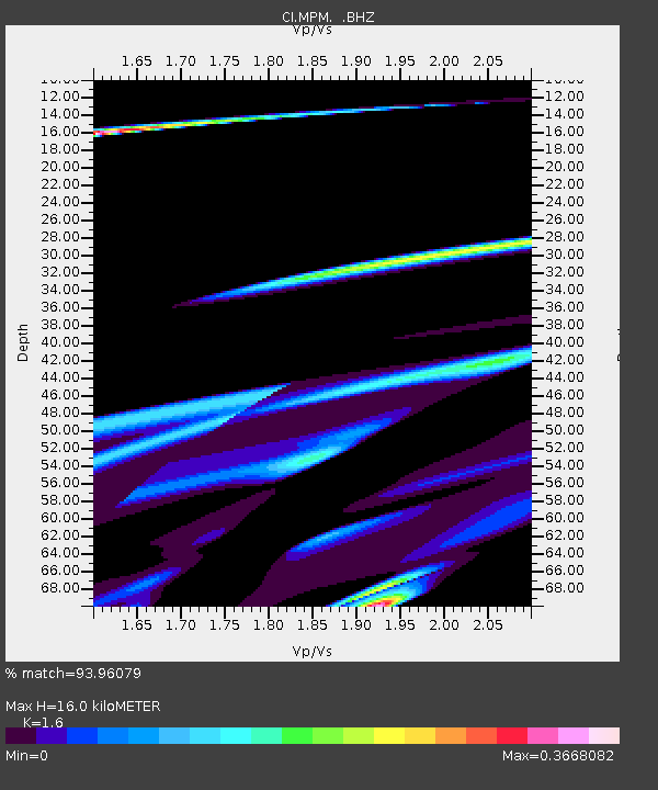
MPM Manuel Prospect Mine, California, USA - Earthquake Result Viewer
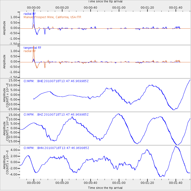
Earthquake location: New Britain Region, P.N.G.
Earthquake latitude/longitude: -5.9/150.6
Earthquake time(UTC): 2010/07/18 (199) 13:34:59 GMT
Earthquake Depth: 35 km
Earthquake Magnitude: 6.1 MB, 7.3 MS, 7.3 MW, 7.3 MW
Earthquake Catalog/Contributor: WHDF/NEIC
Network: CI Caltech Regional Seismic Network
Station: MPM Manuel Prospect Mine, California, USA
Lat/Lon: 36.06 N/117.49 W
Elevation: 185 m
Distance: 95.0 deg
Az: 54.384 deg
Baz: 266.338 deg
Ray Param: 0.04088259
Estimated Moho Depth: 16.0 km
Estimated Crust Vp/Vs: 1.60
Assumed Crust Vp: 6.279 km/s
Estimated Crust Vs: 3.924 km/s
Estimated Crust Poisson's Ratio: 0.18
Radial Match: 93.96079 %
Radial Bump: 370
Transverse Match: 64.92643 %
Transverse Bump: 316
SOD ConfigId: 319893
Insert Time: 2011-01-05 06:46:04.088 +0000
GWidth: 2.5
Max Bumps: 400
Tol: 0.001

Signal To Noise

ChannelStoNSTALTA
CI:MPM: :BHZ:20100718T13:47:46.969985Z2.20142085.860886E-62.66232E-6
CI:MPM: :BHN:20100718T13:47:46.969985Z2.83371382.581191E-69.1088634E-7
CI:MPM: :BHE:20100718T13:47:46.969985Z0.787190441.6222936E-62.0608654E-6
Arrivals
Ps1.6 SECOND
PpPs6.5 SECOND
PsPs/PpSs8.0 SECOND