
MUR Murrieta - Earthquake Result Viewer
| ||||||||||||||||||
| ||||||||||||||||||
| ||||||||||||||||||
|
Signal To Noise
| Channel | StoN | STA | LTA |
| CI:MUR: :BHZ:20100718T13:47:47.347976Z | 0.20719324 | 6.861874E-7 | 3.311823E-6 |
| CI:MUR: :BHN:20100718T13:47:47.347976Z | 1.1899645 | 3.247203E-6 | 2.7288236E-6 |
| CI:MUR: :BHE:20100718T13:47:47.347976Z | 2.4614942 | 5.5515065E-6 | 2.2553402E-6 |
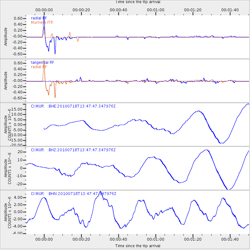
| Arrivals | |
| Ps | 1.2 SECOND |
| PpPs | 4.9 SECOND |
| PsPs/PpSs | 6.1 SECOND |

