You are here: Home > Network List > AV - Alaska Volcano Observatory Stations List
> Station AMKA Regional Station, Amchitka Island, Alaska > Earthquake Result Viewer
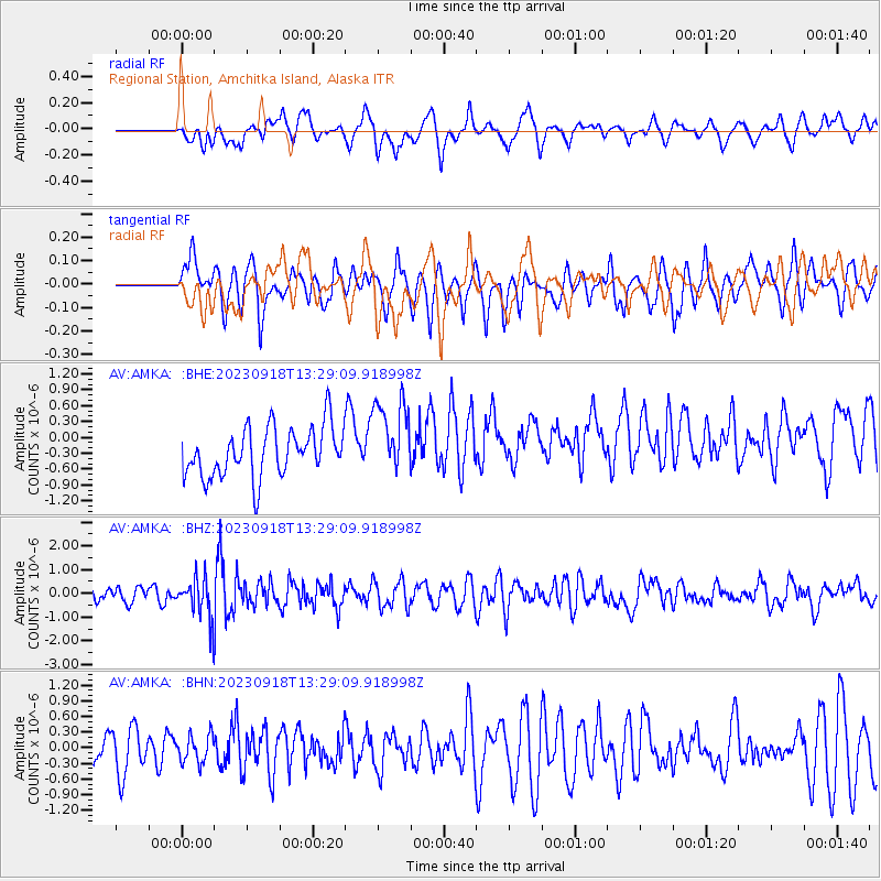
AMKA Regional Station, Amchitka Island, Alaska - Earthquake Result Viewer
*The percent match for this event was below the threshold and hence no stack was calculated.
| Earthquake location: |
Northeast Of Taiwan |
| Earthquake latitude/longitude: |
26.4/125.3 |
| Earthquake time(UTC): |
2023/09/18 (261) 13:21:23 GMT |
| Earthquake Depth: |
183 km |
| Earthquake Magnitude: |
6.3 mww |
| Earthquake Catalog/Contributor: |
NEIC PDE/us |
|
| Network: |
AV Alaska Volcano Observatory |
| Station: |
AMKA Regional Station, Amchitka Island, Alaska |
| Lat/Lon: |
51.38 N/179.30 E |
| Elevation: |
116 m |
|
| Distance: |
47.5 deg |
| Az: |
43.432 deg |
| Baz: |
259.595 deg |
| Ray Param: |
$rayparam |
*The percent match for this event was below the threshold and hence was not used in the summary stack. |
|
| Radial Match: |
47.06041 % |
| Radial Bump: |
400 |
| Transverse Match: |
66.58777 % |
| Transverse Bump: |
400 |
| SOD ConfigId: |
31937991 |
| Insert Time: |
2023-10-02 13:28:25.861 +0000 |
| GWidth: |
2.5 |
| Max Bumps: |
400 |
| Tol: |
0.001 |
|
Signal To Noise
| Channel | StoN | STA | LTA |
| AV:AMKA: :BHZ:20230918T13:29:09.918998Z | 2.5997481 | 9.287212E-7 | 3.5723505E-7 |
| AV:AMKA: :BHN:20230918T13:29:09.918998Z | 0.59391004 | 2.617629E-7 | 4.4074503E-7 |
| AV:AMKA: :BHE:20230918T13:29:09.918998Z | 1.5651026 | 7.3171117E-7 | 4.6751643E-7 |
| Arrivals |
| Ps | |
| PpPs | |
| PsPs/PpSs | |


