You are here: Home > Network List > CI - Caltech Regional Seismic Network Stations List
> Station SWS Sam W. Stewart, Westmorland, CA, USA > Earthquake Result Viewer
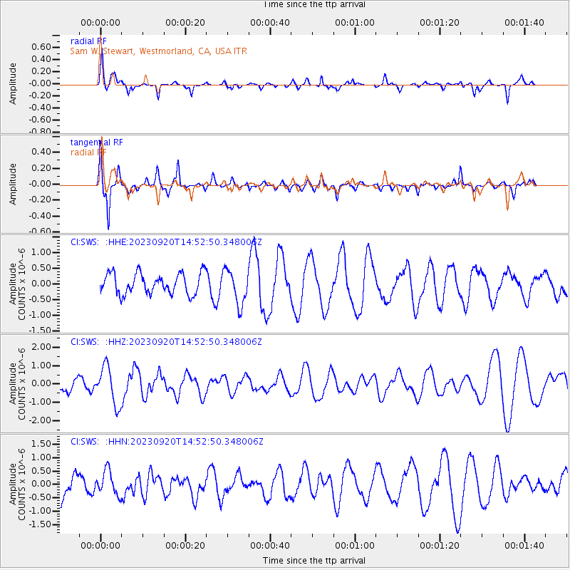
SWS Sam W. Stewart, Westmorland, CA, USA - Earthquake Result Viewer
*The percent match for this event was below the threshold and hence no stack was calculated.
| Earthquake location: |
Central East Pacific Rise |
| Earthquake latitude/longitude: |
-4.5/-105.8 |
| Earthquake time(UTC): |
2023/09/20 (263) 14:45:59 GMT |
| Earthquake Depth: |
10 km |
| Earthquake Magnitude: |
6.0 Mww |
| Earthquake Catalog/Contributor: |
NEIC PDE/us |
|
| Network: |
CI Caltech Regional Seismic Network |
| Station: |
SWS Sam W. Stewart, Westmorland, CA, USA |
| Lat/Lon: |
32.94 N/115.80 W |
| Elevation: |
140 m |
|
| Distance: |
38.5 deg |
| Az: |
346.367 deg |
| Baz: |
163.774 deg |
| Ray Param: |
$rayparam |
*The percent match for this event was below the threshold and hence was not used in the summary stack. |
|
| Radial Match: |
68.66171 % |
| Radial Bump: |
361 |
| Transverse Match: |
75.74498 % |
| Transverse Bump: |
348 |
| SOD ConfigId: |
31937991 |
| Insert Time: |
2023-10-04 14:58:07.851 +0000 |
| GWidth: |
2.5 |
| Max Bumps: |
400 |
| Tol: |
0.001 |
|
Signal To Noise
| Channel | StoN | STA | LTA |
| CI:SWS: :HHZ:20230920T14:52:50.348006Z | 2.2389631 | 1.0774963E-6 | 4.812479E-7 |
| CI:SWS: :HHN:20230920T14:52:50.348006Z | 0.55593413 | 4.5857783E-7 | 8.24878E-7 |
| CI:SWS: :HHE:20230920T14:52:50.348006Z | 1.7265259 | 5.645552E-7 | 3.2698915E-7 |
| Arrivals |
| Ps | |
| PpPs | |
| PsPs/PpSs | |


