You are here: Home > Network List > UU - University of Utah Regional Network Stations List
> Station FORU South Mineral Mountains, UT, USA > Earthquake Result Viewer
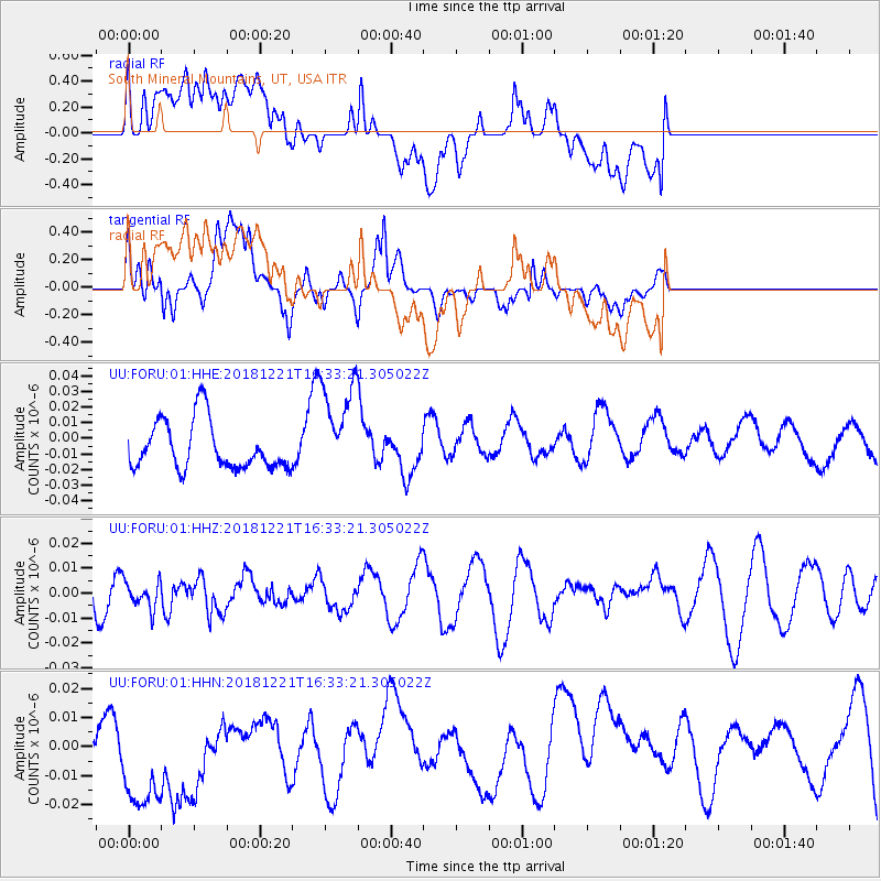
FORU South Mineral Mountains, UT, USA - Earthquake Result Viewer
*The percent match for this event was below the threshold and hence no stack was calculated.
| Earthquake location: |
Komandorskiye Ostrova Region |
| Earthquake latitude/longitude: |
54.8/164.8 |
| Earthquake time(UTC): |
2018/12/21 (355) 16:24:16 GMT |
| Earthquake Depth: |
10 km |
| Earthquake Magnitude: |
5.0 Mww |
| Earthquake Catalog/Contributor: |
NEIC PDE/us |
|
| Network: |
UU University of Utah Regional Network |
| Station: |
FORU South Mineral Mountains, UT, USA |
| Lat/Lon: |
38.46 N/112.86 W |
| Elevation: |
1840 m |
|
| Distance: |
55.6 deg |
| Az: |
70.647 deg |
| Baz: |
315.883 deg |
| Ray Param: |
$rayparam |
*The percent match for this event was below the threshold and hence was not used in the summary stack. |
|
| Radial Match: |
54.263447 % |
| Radial Bump: |
400 |
| Transverse Match: |
58.11622 % |
| Transverse Bump: |
400 |
| SOD ConfigId: |
3201911 |
| Insert Time: |
2019-01-20 15:40:21.736 +0000 |
| GWidth: |
2.5 |
| Max Bumps: |
400 |
| Tol: |
0.001 |
|
Signal To Noise
| Channel | StoN | STA | LTA |
| UU:FORU:01:HHZ:20181221T16:33:21.305022Z | 0.6047365 | 5.459597E-9 | 9.02806E-9 |
| UU:FORU:01:HHN:20181221T16:33:21.305022Z | 2.4851975 | 2.584792E-8 | 1.04007505E-8 |
| UU:FORU:01:HHE:20181221T16:33:21.305022Z | 2.14069 | 3.2644962E-8 | 1.5249737E-8 |
| Arrivals |
| Ps | |
| PpPs | |
| PsPs/PpSs | |


