TUL1 Leonard, OK, USA - Earthquake Result Viewer
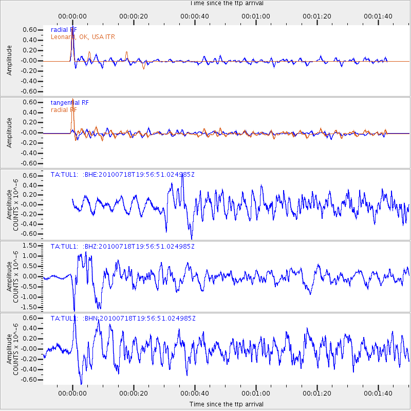
Earthquake location: Fox Islands, Aleutian Islands
Earthquake latitude/longitude: 52.8/-169.7
Earthquake time(UTC): 2010/07/18 (199) 19:48:04 GMT
Earthquake Depth: 10 km
Earthquake Magnitude: 5.6 MB, 5.6 MS, 6.0 MW, 6.0 MW
Earthquake Catalog/Contributor: WHDF/NEIC
Network: TA USArray Transportable Network (new EarthScope stations)
Station: TUL1 Leonard, OK, USA
Lat/Lon: 35.91 N/95.79 W
Elevation: 256 m
Distance: 53.1 deg
Az: 77.299 deg
Baz: 313.165 deg
Ray Param: 0.06632991
Estimated Moho Depth: 21.0 km
Estimated Crust Vp/Vs: 1.60
Assumed Crust Vp: 6.498 km/s
Estimated Crust Vs: 4.061 km/s
Estimated Crust Poisson's Ratio: 0.18
Radial Match: 86.76071 %
Radial Bump: 400
Transverse Match: 48.76573 %
Transverse Bump: 400
SOD ConfigId: 319893
Insert Time: 2011-01-05 07:16:37.856 +0000
GWidth: 2.5
Max Bumps: 400
Tol: 0.001

Signal To Noise

ChannelStoNSTALTA
TA:TUL1: :BHZ:20100718T19:56:51.024985Z8.55341157.9531156E-79.29818E-8
TA:TUL1: :BHN:20100718T19:56:51.024985Z5.1969143.5187702E-76.770884E-8
TA:TUL1: :BHE:20100718T19:56:51.024985Z2.40327552.6567835E-71.1054845E-7
Arrivals
Ps2.1 SECOND
PpPs7.9 SECOND
PsPs/PpSs10.0 SECOND