F23A Volborg, MT, USA - Earthquake Result Viewer
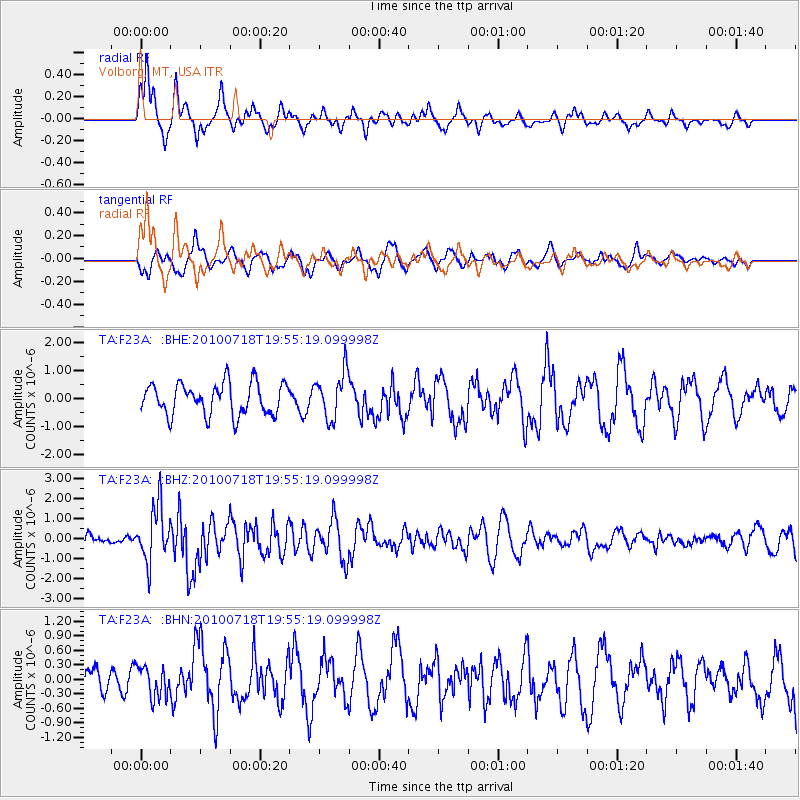
Earthquake location: Fox Islands, Aleutian Islands
Earthquake latitude/longitude: 52.8/-169.7
Earthquake time(UTC): 2010/07/18 (199) 19:48:04 GMT
Earthquake Depth: 10 km
Earthquake Magnitude: 5.6 MB, 5.6 MS, 6.0 MW, 6.0 MW
Earthquake Catalog/Contributor: WHDF/NEIC
Network: TA USArray Transportable Network (new EarthScope stations)
Station: F23A Volborg, MT, USA
Lat/Lon: 45.72 N/105.41 W
Elevation: 953 m
Distance: 41.3 deg
Az: 73.1 deg
Baz: 304.004 deg
Ray Param: 0.07388773
Estimated Moho Depth: 18.75 km
Estimated Crust Vp/Vs: 1.66
Assumed Crust Vp: 6.242 km/s
Estimated Crust Vs: 3.76 km/s
Estimated Crust Poisson's Ratio: 0.22
Radial Match: 80.5139 %
Radial Bump: 395
Transverse Match: 65.912415 %
Transverse Bump: 400
SOD ConfigId: 319893
Insert Time: 2011-01-05 07:18:14.924 +0000
GWidth: 2.5
Max Bumps: 400
Tol: 0.001

Signal To Noise

ChannelStoNSTALTA
TA:F23A: :BHZ:20100718T19:55:19.099998Z4.998861.372948E-62.746522E-7
TA:F23A: :BHN:20100718T19:55:19.099998Z1.04408453.1456878E-73.012867E-7
TA:F23A: :BHE:20100718T19:55:19.099998Z1.48811148.242592E-75.538962E-7
Arrivals
Ps2.1 SECOND
PpPs7.5 SECOND
PsPs/PpSs9.6 SECOND