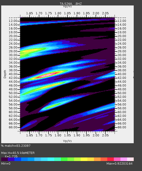
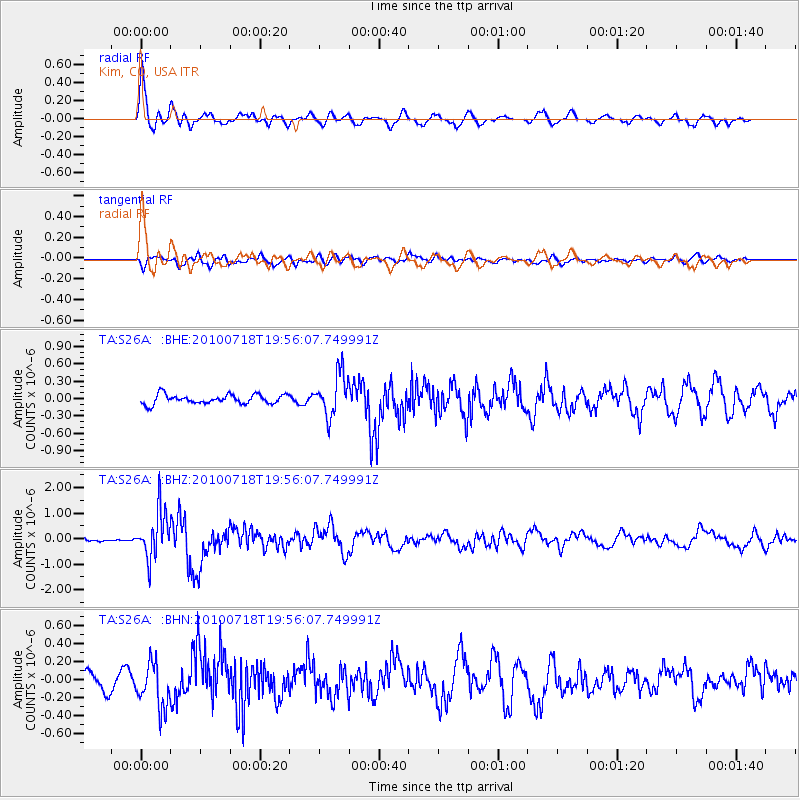
S26A Kim, CO, USA - Earthquake Result Viewer

Earthquake location: Fox Islands, Aleutian Islands
Earthquake latitude/longitude: 52.8/-169.7
Earthquake time(UTC): 2010/07/18 (199) 19:48:04 GMT
Earthquake Depth: 10 km
Earthquake Magnitude: 5.6 MB, 5.6 MS, 6.0 MW, 6.0 MW
Earthquake Catalog/Contributor: WHDF/NEIC
Network: TA USArray Transportable Network (new EarthScope stations)
Station: S26A Kim, CO, USA
Lat/Lon: 37.62 N/103.47 W
Elevation: 1394 m
Distance: 47.4 deg
Az: 81.025 deg
Baz: 310.97 deg
Ray Param: 0.070032574
Estimated Moho Depth: 40.5 km
Estimated Crust Vp/Vs: 1.74
Assumed Crust Vp: 6.306 km/s
Estimated Crust Vs: 3.635 km/s
Estimated Crust Poisson's Ratio: 0.25
Radial Match: 83.23097 %
Radial Bump: 400
Transverse Match: 65.88507 %
Transverse Bump: 400
SOD ConfigId: 319893
Insert Time: 2011-01-05 07:19:27.585 +0000
GWidth: 2.5
Max Bumps: 400
Tol: 0.001

Signal To Noise

ChannelStoNSTALTA
TA:S26A: :BHZ:20100718T19:56:07.749991Z9.3400319.1137736E-79.7577555E-8
TA:S26A: :BHN:20100718T19:56:07.749991Z3.27305252.5006773E-77.6401996E-8
TA:S26A: :BHE:20100718T19:56:07.749991Z4.55909443.62918E-77.960309E-8
Arrivals
Ps5.0 SECOND
PpPs17 SECOND
PsPs/PpSs22 SECOND