
T27A Campo, CO, USA - Earthquake Result Viewer
| ||||||||||||||||||
| ||||||||||||||||||
| ||||||||||||||||||
|
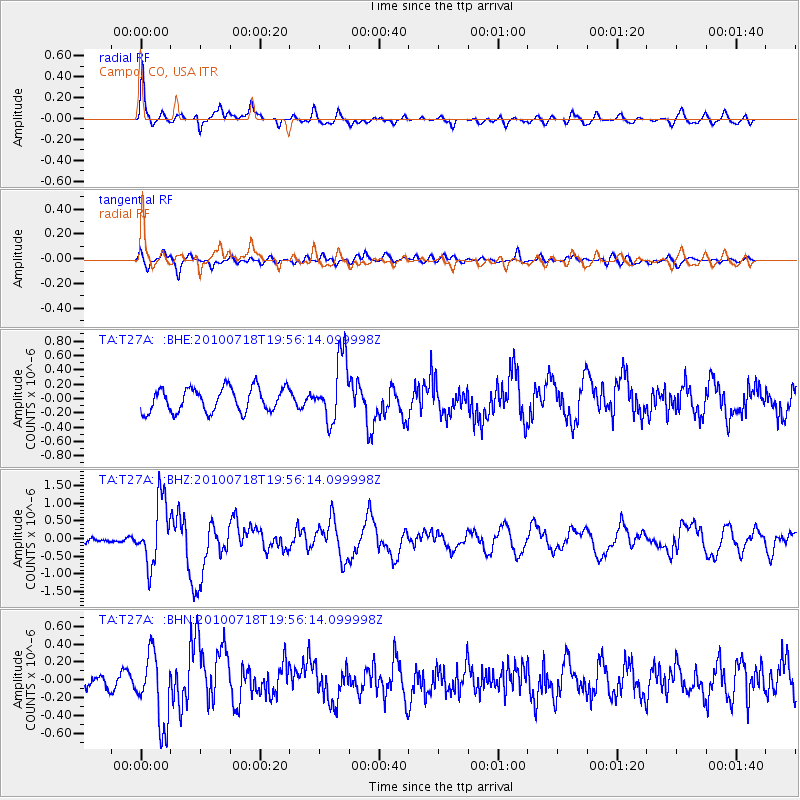
Signal To Noise
| Channel | StoN | STA | LTA |
| TA:T27A: :BHZ:20100718T19:56:14.099998Z | 8.389387 | 9.0281577E-7 | 1.07614035E-7 |
| TA:T27A: :BHN:20100718T19:56:14.099998Z | 4.4959965 | 3.9676095E-7 | 8.824762E-8 |
| TA:T27A: :BHE:20100718T19:56:14.099998Z | 2.6783276 | 4.433453E-7 | 1.6553066E-7 |
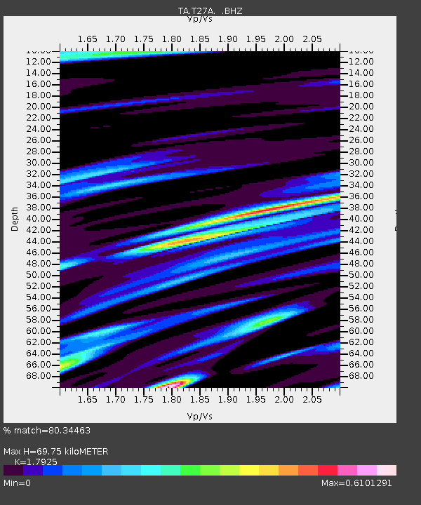
| Arrivals | |
| Ps | 9.3 SECOND |
| PpPs | 29 SECOND |
| PsPs/PpSs | 38 SECOND |

